Overview
Arctic Cruises
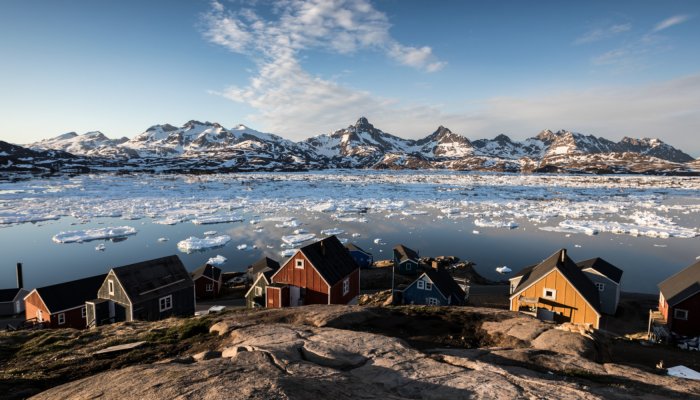
Encompassing huge tracts of untouched wilderness across multiple countries, the Arctic will leave you speechless. Its spectacular coastal landscapes are inhabited by majestic polar bears and some of the world’s most resilient people who have long survived in harmony with its icy oceans.
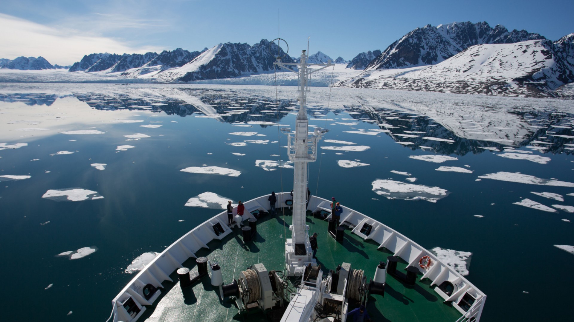
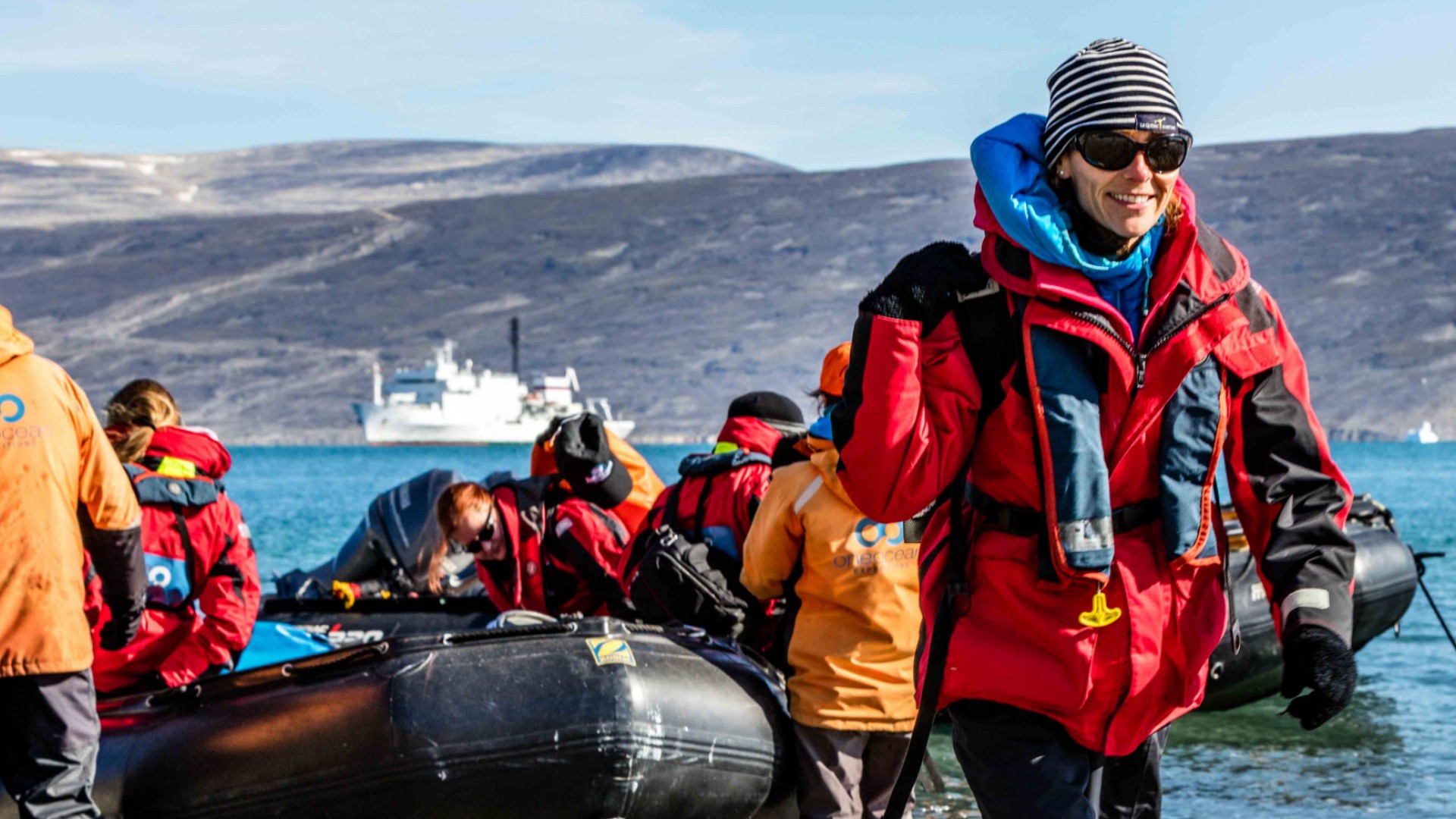
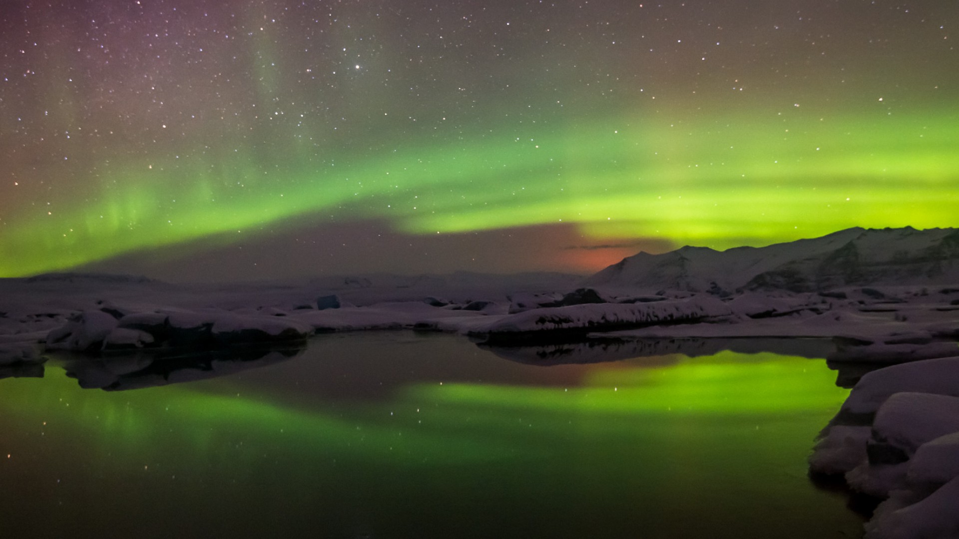
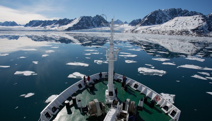
Our Arctic cruises take in the region’s remote communities and dramatic landscapes in hull-hardened ships that are purpose-built for negotiating the polar ice. You’ll discover pristine environments that few have the privilege to witness while being treated to the enthralling natural display of the Northern Lights.
From the wildest reaches of Greenland and Alaska to the storied landscapes of the Canadian Arctic, come join us to explore the final frontier en route to the North Pole.
Custom Tours in Arctic
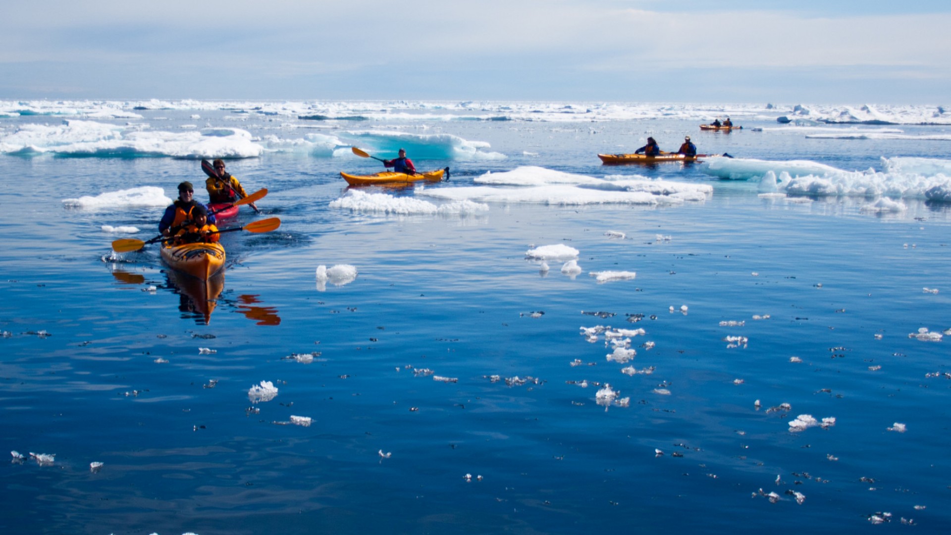
Set out on an unforgettable journey to the Arctic, where wild landscapes, icy waters, and incredible wildlife await. With Adventures Unbound, you can explore this remote region by foot, kayak, or small expedition ship, guided by local experts who know the Arctic’s stories, seasons, and secrets.
We work closely with trusted partners in the Arctic to design custom trips that match your sense of adventure. Whether you’re hoping to see polar bears, paddle alongside icebergs, hike in quiet tundra, or experience life in Arctic communities, we’ll help you build the perfect trip.
Ready to start planning? Fill out the form below!
Image & Video Gallery
Country Guide
History
History is marked with obscure references to early Arctic exploration, though rudimentary navigation techniques and unsound geographical concepts make early accounts and maps unreliable at best. Perhaps the first attempt to reach the Arctic belongs to a Greek named Pytheas, who sailed from the Mediterranean to a land he dubbed Thule, which was possibly Norway, Iceland or the Shetlands. Though accounts of Pytheas’ exploits were largely discredited for hundreds of years, the haunting idea of Thule—the possible end of the world, still shrouded in mystery—persisted.
Arctic exploration picked up in the 8th and 9th centuries. Irish monks traveled to Iceland in the 8th and 9th centuries but vikings were the island’s first permanent settlers by the end of the 9th century. The vikings were intrepid explorers, though they left negligible records. Over the course of several centuries, they made it to Greenland, the coast of North America and possibly even Novaya Zemlya and Svalbard. They also established two settlements and various trade routes to the White Sea. However, their lack of proper documentation left much of this terrain to be rediscovered over the course of time.
Over the course of history, Arctic exploration centered around two primary passages: the Northeast Passage and the Northwest Passage.
INDIGENOUS CULTURES
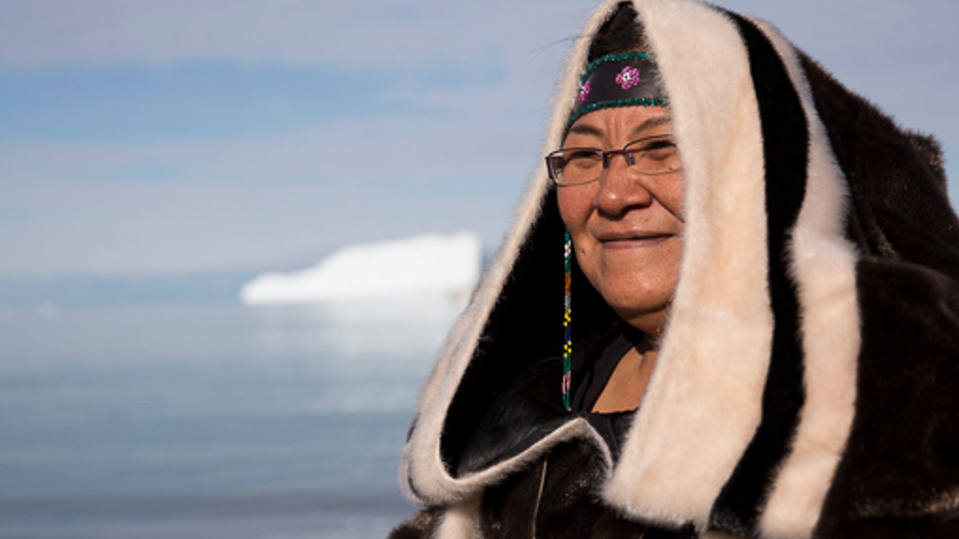
The indigenous, or circumpolar, population of the Arctic consists of over 30 unique peoples and a multitude of languages.
The indigenous peoples largely live off of hunting, fishing, trapping and some pastoralism rather than agriculture.
The different adaptive behaviors used by the circumpolar populations can be broadly classed into four behaviors:
- Exploiting a range of territory from a central location, enjoying the diverse resources of fish, land animals, birds and vegetation from within largely forested regions.
- Depending upon migrant herds of caribou throughout the year from annually nomadic movements, generally spanning the tundra to the forest.
- Seasonal migration (largely by the Inuit groups), hunting marine life along the coast in winter and spring and fishing and hunting caribou on the continental tundra in the summer and fall.
- A fully maritime existence from a fixed location (largely typical of northern Pacific cultures), enjoying the coastal resources throughout the year.
The seasonally migrant American Arctic Inuit and northern Yupiit spend summers hunting caribou and fishing, while the colder seasons were spent hunting for sea mammals, particularly seals. In winter, the people groups lived in semi-buried houses of sod or stone or in the famous “snow houses” (or igloos), allowing them to travel to the fresher ice fields.
Meanwhile, the nomadic Eurasian Sami also built temporary structures: the tent-like lavvu. However, the Sami had access to the subarctic boreal forests and taiga, allowing them to built more permanent structures such as elevated storehouses. No matter the location, Arctic cultures depended upon weatherized buildings that were able to supply efficient insulation.
EURASIAN ARCTIC AND SUBARCTIC PEOPLES
boreal forest (or taiga, or snow forest)
The indigenous people of northern Eurasia can mostly be found inhabiting the boreal forest (otherwise known as the snow forest or taiga) throughout the year or migrating between the tundra and boreal forest. There are also the Siberian Yupik and coastal peoples of the Chukchi and Koryak.
As with most circumpolar peoples, those who inhabit northern Eurasia cannot be demarcated into “tribes”; rather, their territorial and ethnic boundaries are fluid and often hazily defined. They are also outnumbered by immigrant Swedes, Norwegians, Finns and Russians. For instance, research shows that the ratio of immigrants to natives switched from a 1:4 minority to a 4:1 majority in the mid-20th century.
NORTHWESTERN SIBERIA AND FENNOSCANDIA PEOPLES
The largest indigenous groups found in northwestern Siberia are the Nenets, and the they can be found from the western White Sea to the eastern Yenisey River. East of the Yenisey river are the Nganasan , who inhabit the Taymyr Peninsula. The southern stretches of the Yenisey are inhabited by the Enets, who can be found in the Turukhan and Taz river basins. Many of these cultures combine hunting and fishing with reindeer husbandry to survive.
Toward the southern forested land surrounding the Ob River, the Khanty and Mansi can be found. They also traditionally lived off of hunting and fishing, and later took up reindeer husbandry from the Nenets in the 15th century. The Selkup also inhabit the Ob basin’s forested regions, and the Ket could once be found throughout the Yenisey basin. However, they experienced widespread distribution after continued contact with Russians and other people groups throughout the 18th-19th centuries, leaving only the northernmost Kets centralized.
The Nordic region of Fennoscandia—or Fenno-Scandinavia or the Fennoscandian Peninsula—may not necessarily be a household name, but it is definitely a significant one as it comprises the Scandinavian Peninsula, Finland, Denmark, the Kola Peninsula, Karelia. The indigenous Sami inhabit northern Fennoscandia, having once lived throughout the Kola Peninsula, Karelia, Finland and the Scandinavian mountain chain. As the Scandinavian and Finnish agricultural settlements expanded over the centuries, the Sami’s country contracted to the northernmost regions of Fennoscandia. Though many took up the livelihoods of farming and fishing, the Sami largely identify with an ethnic identity formed around a livelihood of nomadic reindeer pastoralism. The Komi-Zyryan can be found between the Vychegda and Pechora rivers, and retain some small degree of autonomy within Russia.
NORTHEASTERN AND NORTH-CENTRAL SIBERIAN PEOPLES
Further east of the Yenisey, the Sakha are the dominant indigenous group, extending down the Lena River. The Evenk—who had previously been known as the Tungus—inhabit a vast territory about a quarter of Siberia further east. Their different livelihoods are largely defined by geography, with the southern Evenk surviving as pastoralists who keep cattle and horses and coastal Evenk live a semi-nomadic lifestyle and those within the forest live as trappers and hunters. The Even and Dolgan are closely related to the Evenk people.
The Paleo-Siberian peoples, comprising the Itelmen, Yukaghir, Chukchi and Koryak people groups, inhabit Siberia’s northeasternmost regions. While the Chukchi inhabit the aptly named Chukchi Peninsula and Anadyr Plateau, the Koryak inhabit the Koryak plateau and some of the Kamchatka Peninsula, which they share with the Itelmen. The Siberian Yupik, or Eskimo, live amongst the Chukchi along the Bering Sea and Wrangel Island. The incredibly-reduced Yukaghir only have two two groups surviving today: the Kolyma Yukaghir and the Tundra Yukaghir. These groups live within the forests of the Alazeya and Kolyma rivers.
AMERICAN ARCTIC PEOPLES
Throughout the American Arctic, the Eskimo (otherwise known as the Inuit or Yupik/Yupiit) and the Aleuts inhabit the shores and hinterlands. The Alaskan Yupik have close genetic, linguistic and social relations to the Siberian Yupik, and so sometimes scholars conflate the two groups.
Traditionally, American Eskimos didn’t classify their unique societies by clans or tribes, instead identifying different people groups by place of residence—a factor distinguished by the suffix -miut, meaning “people of.” Self-identity was further modified by connections of marriage and kinship.
The indigenous cultures of the American Arctic have generally been divided into two categories: the more sedentary groups inhabiting near or on the open-water regions of the Pacific coasts (the southern Aleuts and Yupiit), and the migrant peoples who inhabited the coastlines frozen in winter (the northern Aleuts and Yupiit).
The Northeast Passage
ENGLISH AND DUTCH EXPLORATION
The English and the Dutch resumed exploration of the Eurasian Arctic by the early 16th century—a move largely motivated by the desire to trade with the far East. As many of the southern trade routes rounding South America and Africa were claimed by Spain and Portugal, and were extensive undertakings as well, the northern latitudes offered enticing possibilities.
Britain first attempted to navigate the Arctic in 1533, sending out three ships commanded by Sir Hugh Willoughby alongside Richard Chancellor. While Willoughby and two ships of men perished on the Kola Peninsula, Chancellor was able to reach Archangel before returning to England via a terrestrial route to Russia.
Of course, these waters were very familiar to the Russians, who often navigated routes from Norway to western Europe, but these exploits were not public knowledge. Chancellor’s own excursions led to the development of the Muscovy Company as well as profitable trade routes with Russia. The English lost interest in the Northeast Passage relatively quickly, however, due to their lucrative relationship with Russia. While Stephen Borough set out in 1556 and made it to the mouth of the Kara Sea and Arthur Pet and Charles Jackman once again attempted to breach the Ob River in 1580, these unsuccessful attempts did little to inspire the English.
The Dutch’s Arctic efforts were largely inspired by the work of Olivier Brunel, who established a trading post on Archangel in 1565 but wasn’t able to reach the Ob River by sea. Willem Barents followed in Brunel’s footsteps and discovered Novaya Zemlya in 1594. The excitement surrounding Barents’ journey to Novaya Zemlya’s northern tip was somewhat dampened by the wreckage left along the coast, clearly indicating the Russians’ previous presence in the region.
Barents’ 1596 journey was more successful. Sailing north from Norway rather than circumnavigating the coastline, led Barents to Svalbard and Bear Island, which he mistakenly thought was Greenland. Barents and a portion of the party stayed behind and wintered in Ice Haven, becoming the first recorded Europeans to have wintered in the Arctic successfully. That being said, Barents died on the return journey home.
Perhaps fortuitously, Barents’ Arctic winter influenced Henry Hudson’s epic 1609 journey into the Barents Sea. In fear of having to winter in the Arctic like Barents, Hudson’s crew mutinied and compelled him to alter his course. Hudson ultimately traveled west to the coast of Virginia, where he sailed the Hudson River.
RUSSIAN EXPLORATION
The Russians had established an Arctic trade route by the late 16th century, a route running along the coast from the Northern Dvina River to Yamal via the Yugorsky Shar Strait. Though Tsar Michael discontinued the use of this route in 1616, the Russian presence was felt.
By the mid-17th century, the Cossacks regularly traversed the Lena-Kolyma region further east. By 1648, they attempted to penetrate further into the Arctic. Semyon Dezhnyov headed the expedition, sailing east for the Anadyr River basin and thereby becoming the first European to venture through the Bering Strait.
Documentation from Dezhnyov’s voyage was relatively obscure, so Peter the Great commissioned Vitus Bering to command an expedition to the Bering Strait region in the 1720s. Though Bering discovered the Diomedes and St. Lawrence Island as well as penetrating far north through the Bering Strait, he did not sight the Alaskan coast.Several years later, Ivan Fyodorov and Mikhail Gvozdev became the first Europeans to site Alaska upon discovering Cape Prince of Wales and the coastline around Nome.
The Russians followed up these discoveries with the greatest Polar operation to this day: the Great Northern Expedition of 1733-1743. Bering once again headed the operation which consisted of 7 distinct detachments tasked with exploring various regions of the Pacific coast and Arctic. 62 maps and charts were produced over the course of 8 years and vast amounts of terrain were explored. Though the data gathered proved vital to later explorers, the hardships and unnavigable waterways encouraged the Russians to believe the Northeast Passage wasn’t a practical option.
Due to these difficulties, a gap in Arctic charts remained, stretching from Chaun Bay to the Bering Strait. Englishman James Cook partly filled in this gap in 1778, inspiring Russia’s Catherine II to fund another expedition to the Chukchi Peninsula in 1791. However, it wasn’t until 1823 that Ferdinand Petrovich Wrangel mapped Chukchi’s northern coastline.
PENETRATING THE NORTHEAST PASSAGE
The Northeast Passage was finally overcome in 1878-79 by Adolf Erik, Baron Nordenskiöld of Sweden. The Russians traversed the Northeast Passage in 1914-15 during the Arctic Ocean Hydrographic Expedition. The first one-season (and accident-free) traverse of the Northeast Passage was completed in 1934 by the icebreaker Fedor Litke—a ship which accompanied the Arctic’s first freighters through the passage in the opposite direction the following season.
The Northwest Passage
EARLY ATTEMPTS AT EXPLORATION
The discovery of America certainly inspired the search for the Northwest Passage, as Jacques Cartier, John Cabot, Gaspar and Miguel Corte-Real all set off in search for the passage. English explorer Martin Frobisher was the first to voyage into the Arctic, however, in 1576 when he landed on Baffin Island. Despite Frobisher’s discoveries, interest in the Northwest Passage languished for several years until John Davis’ explorations of 1585-87. During these expeditions, Davis rediscovered Greenland, charted Baffin Island and Labrador, and explored Cumberland Sound. He also sighted, but did not explore, Hudson Strait and Frobisher Bay.
The early 17th century saw various British expeditions into the Arctic, led by George Weymouth, Henry Hudson, Thomas Button, William Baffin and Luke Foxe. Significantly, Baffin explored Baffin Bay by 1616, though the import of his discovery was not perceived for 200 years as his map was never published, leaving the existence of the bay in doubt. Baffin had discovered the bay’s western region as well as three sounds. However, Baffin mistakenly believed the sounds were only bays and concluded there was no passage out of Baffin Bay.
19TH CENTURY ATTEMPTS
The ensuing quiet after the Napoleonic Wars saw a resurgence in British interest in the Northwest Passage. A number of relatively unsuccessful ventures occurred throughout the early 19th century. Navigators found themselves blocked by ice and Captain John Ross even found himself repeating Baffin’s error in believing Baffin Bay’s sounds to be more bays. John Ross’ expedition of 1829-33 proved the most successful, largely through the efforts of James Clark Ross who established the location of the North Magnetic Pole.
The English also made various attempts to breach the Northwest Passage from the west during the same timeframe. John Franklin led two expeditions from 1819-22 and 1825-27, during which he surveyed much of the coastline from Turnagain Point to Cape Beechey, Alaska. The uncharted gaps of the Alaskan coastline left by Franklin were filled in by Hudson’s Bay Company employees Peter Warren Dease and Thomas Simpson. Their work was followed up by John Rae, another Hudson’s Bay Company employee, who further explored the Gulf of Boothia. Rae gains even more recognition for being a cunning traveler who adopted the Inuit methods of living off the land while traversing the harsh countryside.
The Northwest Passage remained elusive despite these accomplishments. As such, the British commissioned Sir John Franklin with another attempt. Franklin sailed the HMS Erebus and Terror from Lancaster Sound in 1845, only to be never heard from again despite a 12-year ensuing search. Over time, and assembling the evidence discovered by multiple search parties, Franklin’s story has somewhat been pieced together. It appears that Franklin and his party had ventured up Wellington Channel and wintered at Beechey Island; in spring, Franklin sailed into the previously unnavigated Peel Sound into Victoria Strait, where he ultimately abandoned his ships. Though there were no survivors, the search parties themselves proved fruitful in furthering Arctic discovery. Robert McClure accidentally found himself the first person to traverse the Northwest Passage, though he traversed it in several ships (after he was rescued) and partly on foot.
20TH CENTURY TRAVERSES
Official recognition for discovering the Northwest Passage went to Robert McClure, though the ill-fated Franklin had also discovered its existence. Norwegian Roald Amundsen followed up these attempts in 1903; during his 3-year excursion he not only amassed a quantity of scientific excursions but became the first to fully traverse the Northwest Passage. After this, the Northwest Passage has been traversed by icebreakers and commercial ships, though it’s not regularly used as a commercial route.
The Search for the North Pole
ATTEMPTS FROM SVALBARD & GREENLAND
The search for the North Pole began rather belatedly, and even then the earliest attempts at the pole were truly in search of the Northeastern Passage. Hudson made an attempt for the pole in 1607, after which 200 years passed before the next attempt. This attempt was inspired by Mikhail Vasilyevich Lomonosov, who believed—as many others did at the time and for the next 100 years—that an open polar sea existed. The Russians sent out several expeditions who operated under Lomonosov’s proposition and attempted to reach the pole from Greenland and Svalbard.
Search parties for Franklin opened up another option running up Greenland’s western coast. Several attempts, largely led by Americans and the British, made attempts for the pole via this new route in the late 19th century. Attempts from the Svalbard route also occurred during this time, though they were no more successful.
THE POLAR RACE
The Fram expedition, during which the ship drifted for 3 years and proved the polar basin’s central region was an ice-covered sea, changed the nature of the international race for the pole. With the discovery that any remaining undiscovered Arctic land was peripheral rather than interior, countries became less interested in scientific exploration and more interested in polar exploration as a form of sport.
A significant controversy mars this era, as rival claims still exist as to who reached the North Pole first: Robert E. Peary in 1908-09 or Frederick A. Cook in 1907-09. Neither explorer produced conclusive evidence in support of his claim, so both claims remained shrouded in doubt.
As such, American Ralph Plaisted has the honor of having the first confirmed surface expedition to have reached the North Pole in 1968. Britain Wally Herbert reached the North Pole the following year via dog team, while U.S. nuclear submarines reached the pole in 1958 and 1959 and the Soviet icebreaker Arktika was the first surface ship to have reached the pole in 1977.
Wildlife
Birds
Many of the land birds who visit the Arctic are migratory, coming north from wintering grounds as far south as Brazil, Central America, or even the subantarctic region. The migratory birds visiting the Arctic get to enjoy the region’s intense summer growing season and the longer, warmer summer days. Common freshwater and land birds found in the Arctic include loons, ducks, geese, rock ptarmigans, sandpipers, redpolls, snowbirds, wheatear, pipit, Lapland longspurs, and some some plovers.
Many seabirds seasonally migrate to the Arctic to soak up the sun in the summer months, but there are some common family groups you can identify such as the auk family (which includes auklets, little auk, guillemots, and murres), gulls and terns (in particular the glaucous-winged and glaucous gulls, Sabine’s gull, herring gull, and the arctic and common terns), the waders (such as the sandpiper), the jaegers, and the petrel group (represented by the fulmar, who breeds on some Arctic cliffs).
ARCTIC TERN
The arctic tern is a long-distance record holder: some migrate from the High Arctic to the Antarctic, going farther than any other bird. The small, white bird breeds in the Arctic or as far south as New England and Washington State then winters in the northern regions of the Antarctic, a yearly migration covering perhaps 25,000 miles. During its travels, the arctic tern passes over every ocean and passes near every continent.
The small birds tend to be gray or white during the breeding season, while their legs and beak are red. A black patch coats their head, though this patch shrinks during the winter season.
ATLANTIC PUFFIN
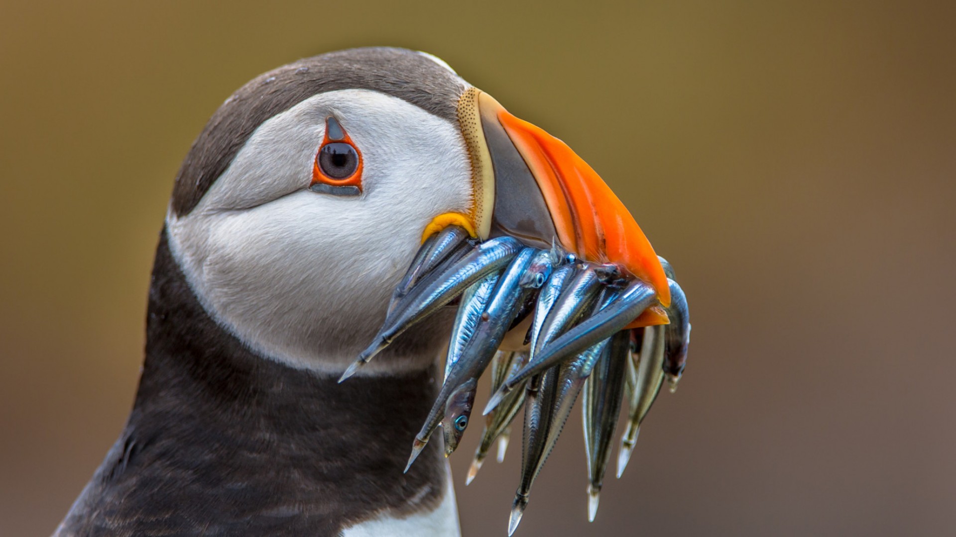
Atlantic puffins may look a bit like little penguins, but their vibrant beak has them sometimes going as the “sea parrot.” Much like many other Arctic birds, these sea parrots experience seasonal physiological changes, as their beak turns into a muted grey in winter before being painted with color once again in the spring.
Puffins largely live at sea, swimming underwater as if they were flying or sometimes resting upon the waves. When swimming, puffins can dive up to 200 feet and use their wide webbed feet as a rudder to steer. When they do take off in flight, they have to take a running start.
Puffins can be found throughout the Arctic’s seacoasts and islands when they form breeding colonies every spring—they only time they come to land. Iceland in particular hosts about 60% of the Atlantic puffin population. Look out for steep seaside cliffs where puffins like to build their nests.
FUN FACT: Puffins frequently meet back up with their mate at their same burrow year after year, though no one’s quite sure how they find their way back.
GYRFALCON
The largest falcon in the world, the gyrfalcon can be found across the High Arctic soaring after ptarmigans or streaking down from the sky in search of prey. These birds of prey have bodies perfectly engineered for haunting the Arctic Circle’s skies; a wingspan stretching up to 4ft and a body weighing up to 5lbs generates the power and the speed needed for quick take-offs. While the gyrfalcon’s speed remain estimated, the conservative estimate is 90 mph in level flight and 150 mph in stoop.
FUN FACT: In Medieval times gyrfalcon’s were a highly sought after prize, often owned by kings signaling their power.
PTARMIGAN
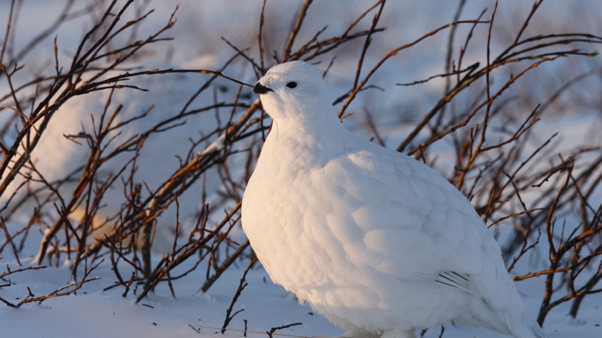
Ptarmigans, part of the grouse family, are among the best for adapting to the Arctic’s frosty winter temperatures and elevations. Like some of the Arctic’s other well-adapted creatures, such as the arctic fox and hare, the ptarmigan experiences physiological changes to better survive. In the summer, the ptarmigan’s gray-brown plumage transforms into a crisp, snowy white every year when winter starts coming.
But these birds have more than changing feathers to their name. They also sport seasonal footwear, as every fall they switch out scales for small spiky protrusions called pectinations that almost double the surface area of the ptarmigan’s foot. The ptarmigan’s footwear even goes a step further, as they have wide foot-feathers that resemble insulated snowshoes, providing both warmth and a greater surface area.
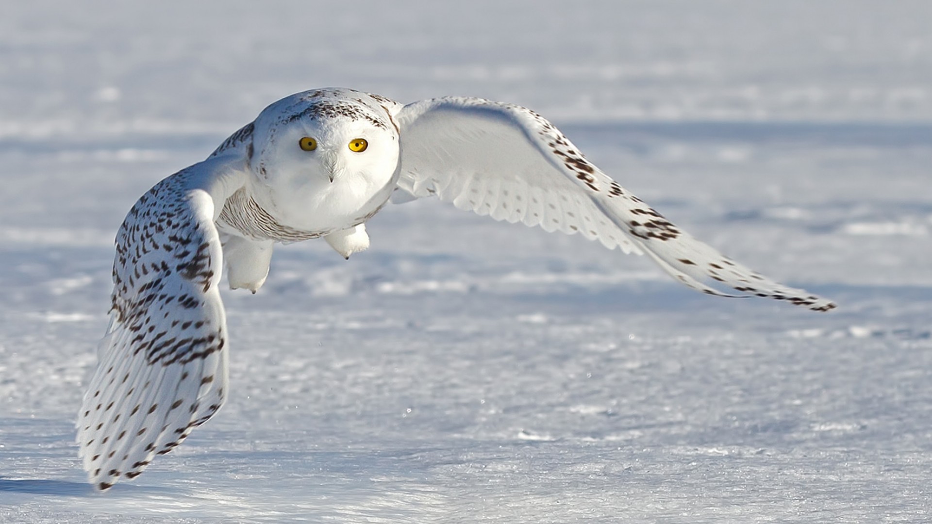
SNOWY OWL
The snowy owl fits right into its Arctic environment with its white plumage. While males get whiter as they get older, females are spotted with dusky plumage and never become completely white like some elderly males.
Like many owls, the snowy owl is a patient hunter who singles out its quarry before pursuing it with sharp talons. In the Arctic, their diet largely consists of lemmings. While they supplement their diet with birds, rabbits, rodents and fish, they can eat up to 3-5 lemmings a day—totaling 1,600 lemmings a year.
FUN FACT: Snowy owl parents are incredibly territorial and will defend their nests against any animals passing by — even wolves.
Wales
Other visitors include: Rorqual, Finback, Sperm, and Blue Whales.
BELUGA
The white whales of the Arctic: belugas. The iconic white color even gave the whales their name, as “beluga” means “white one” in Russian. If the white body wasn’t enough to tip you off when seeing a beluga, the lack of dorsal fin is another particular trait. This particular lack of fin allows the beluga to easily skim the water under the floating ice sheets. They can also turn their necks in all directions—a unique trait amongst whales—as another handy adaptation for surviving the Arctic waters and the polar bears and orcas that hunt them.
Belugas are also known as Sea Canaries, a monicker they picked up for the high pitched squeals, whistles and clicks they make when communicating.
FUN FACT: While belugas are armed with a mouth full of teeth, they only use their teeth to snap up their prey and hold on rather than chew. Belugas prefer to swallow their prey whole.
NARWHAL
Narwhals, the veritable unicorn of the sea, may appear mythical with the tusk protruding from their head, but these pale porpoises can be found in the chilly Arctic coastal waters and rivers. They are best known for their tusk, which is truly a large tooth with sensory capabilities that can grow as long as 10 feet. Some narwhals can grow up to two of these spiraling horns, yet some grow none. Despite tusks being a narwhal’s most prominent feature, scientists are actually uncertain as to its purpose.
Narwhals, related to belugas, bottlenose dolphins, orcas and harbor porpoises, often travel in large groups of 15-20, though sightings of groups as large as several hundred or several thousand have been reported. Many narwhals are known to winter for up to five months in the Baffin Bay and Davis Strait region.
FUN FACT: Unlike the horn of their fantastical unicorn counterpart, a narwhal’s spiraled tusk doesn’t grow out of its forehead. Rather, this tusk actually serves as a tooth which grows straight through the narwhal’s upper lip.
ORCAS
Unlike Arctic whales, orcas—migrant visitors—are not well-adapted to the unique and harsh environment. The biggest impediment is their big dorsal fin. Unlike the beluga, whose lack dorsal fins allow them to easily navigate the waters underneath the ice sheets, orcas have that dorsal protrusion keeping them from skimming close underneath the sea ice. To avoid heavier ice formation during the winter months, orcas in the Canadian Arctic migrate further south.
FUN FACT: As Arctic ice moves out, orcas are moving in. The melting, receding Arctic ice creates an ecosystem more fit for orcas, so the whales are enjoying wider, longer access to the Arctic. Of course, this means they’re competing with the polar bear as the Arctic’s top predator.
BOWHEAD
Bowhead whales, second in size only to the massive blue whale, are a predominately Arctic species. To survive the Arctic’s cold waters, the bowhead requires excellent insulation, and it is so equipped with the thickest blubber found on any animal: half a meter. The bowhead whale also has a suitably enormous bow-shaped mouth filled with 3-meter tall baleen plates, making it the largest mouth of any animal in the world. Despite their massive size, bowheads can leap entirely out of the water. Their thick skulls and powerful physique also help the bowheads break through thick Arctic ice, though shifting ice flows still play a significant role in the whale pods’ movement patterns.
Female bowheads are quite the coquette, and are maybe the most flirtatious of the ocean mammals. They frequently tease the male bowheads into quite a fit of excitement.
FUN FACT: Discoveries suggest that bowheads may be the longest living animals on earth, with lifespans extending over 100 years—possibly reaching 200 years.
Marine Mammals
WALRUS
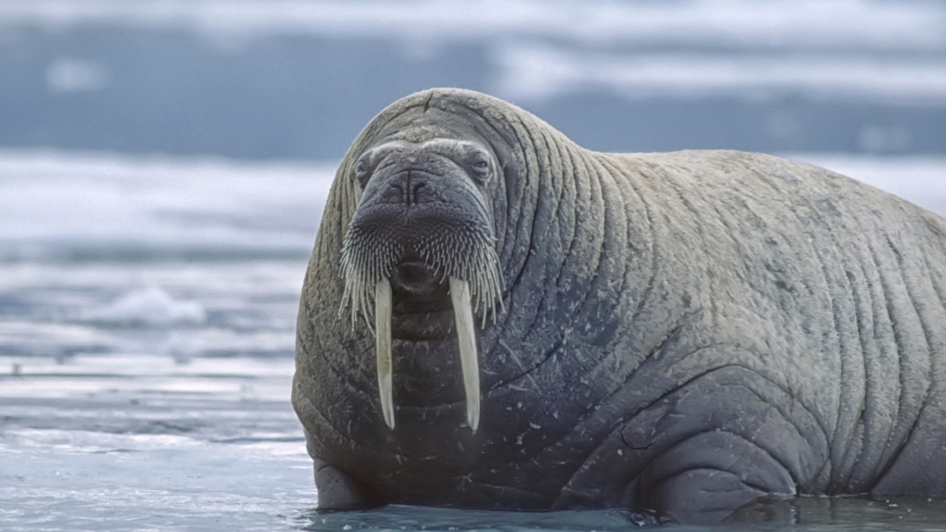
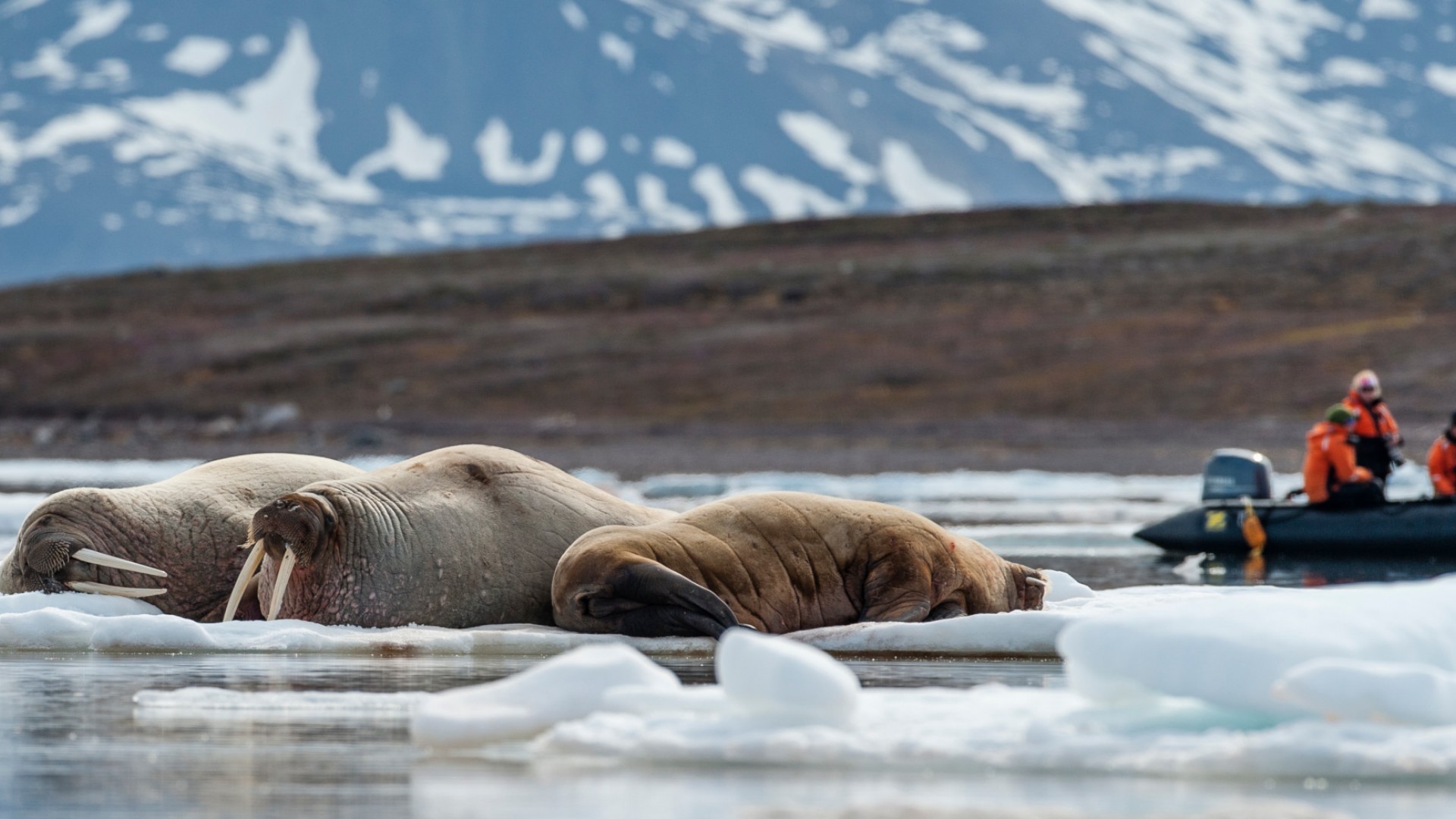
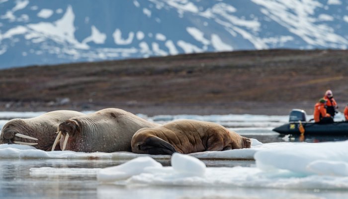
The blubbery, tusked, mustachioed walrus can often be seen lounging around on the Arctic ice. When it’s not mating season, walruses are incredibly affable creatures who enjoy loudly barking and snorting to their friends.
Their long white tusks aren’t just for show, and walruses use them to handle the unique Arctic habitat. They’ve gained a reputation for “tooth-walking” as they use the tusks to pull their massive bodies up out of the water and break through the ice from below to create breathing holes. Bulls also use their tusks to defend their territory or protect their harem of cows during breeding season.
Walruses have another set of Arctic adaptations. Their mustache isn’t just for panache, as their sensitive whiskers are helpful in detecting their favorite shellfish on the sea floor. Their heavily blubbered bodies also help them survive the chilly polar temperatures.
BEARDED SEALS
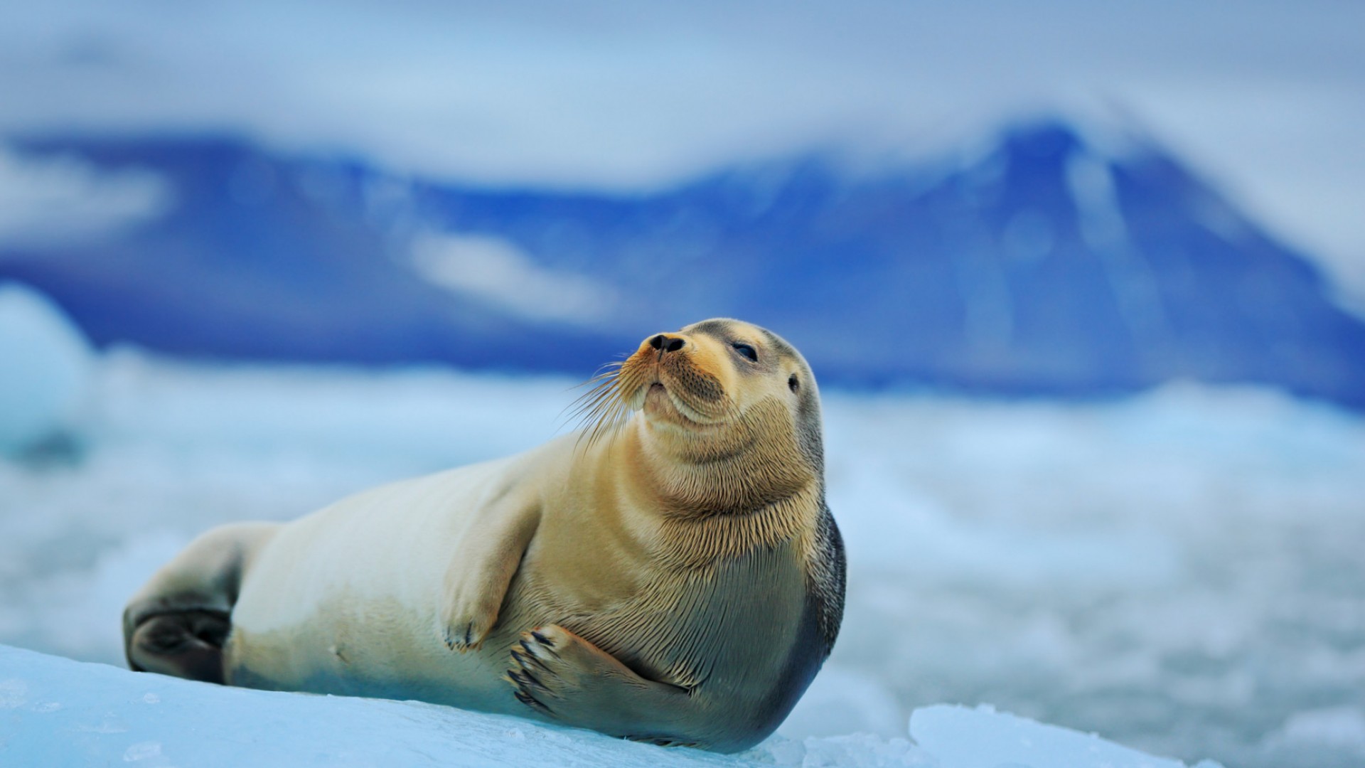
The largest of all the Arctic seals, the bearded seal can grow up to 8 feet and weigh up to 575-800 pounds. Adult bearded seals usually stay near shallower bays, where it’s easier to for the benthic feeders to forage for fish and other invertebrates such as clams and crabs.
MIGRANT HARP SEALS
Harp seals are migrant visitors to the Arctic ocean, a feat served by their sleek swimming bodies. You might best recognize the fluffy white harp seal pups, who keep their wooly white fur for 2-3 weeks to blend into the wintry environment. Meanwhile, adult harp seals are covered in a light grey fur marked with a black face and a black, horseshoe-shaped “saddle” resembling a harp—a marking which gives the seals their name.
Adults take good care of the fat, fuzzy pups, feeding them up to 5 times a day to build up baby blubber. But such good care is short lived, as the pups are left alone after only 12 days. Once they’ve gone solo, pups spend much of the next couple of weeks conserving energy and lying low—and losing their whitecoats. They also begin to venture closer to the ice sheet’s edge as they become accustomed to the water. At this stage, the pups are known as beaters due to the way they beat the water with their flippers as a form of swim practice.
Practice must serve harp seals well, as later in life they spend very little time on land and instead prefer to swim in the Arctic and North Atlantic Oceans. They can even remain submerged underwater for up to 15 minutes at a time—quite a feet for these earless seals.
RINGED SEALS
The most widely distributed and common seal in the Arctic, ringed seals can be found throughout the northern circumpolar oceans. They get their name from the lightly-colored circular markings lining their dark gray backs. The pattern can appear more splattered than circular, however, due to its dense nature.
Ringed seals—the smallest of the seal species—mainly stay near shore ice, but they are able to swim out much farther from the ice’s edge due to their ability to make and maintain breathing holes. The seals burrow out the cone-shaped breathing holes with the claws lining their front flippers. The breathing holes serve another purpose as the ringed seals are known to blow bubbles up it from below to check for the presence of polar bears, their primary predator.
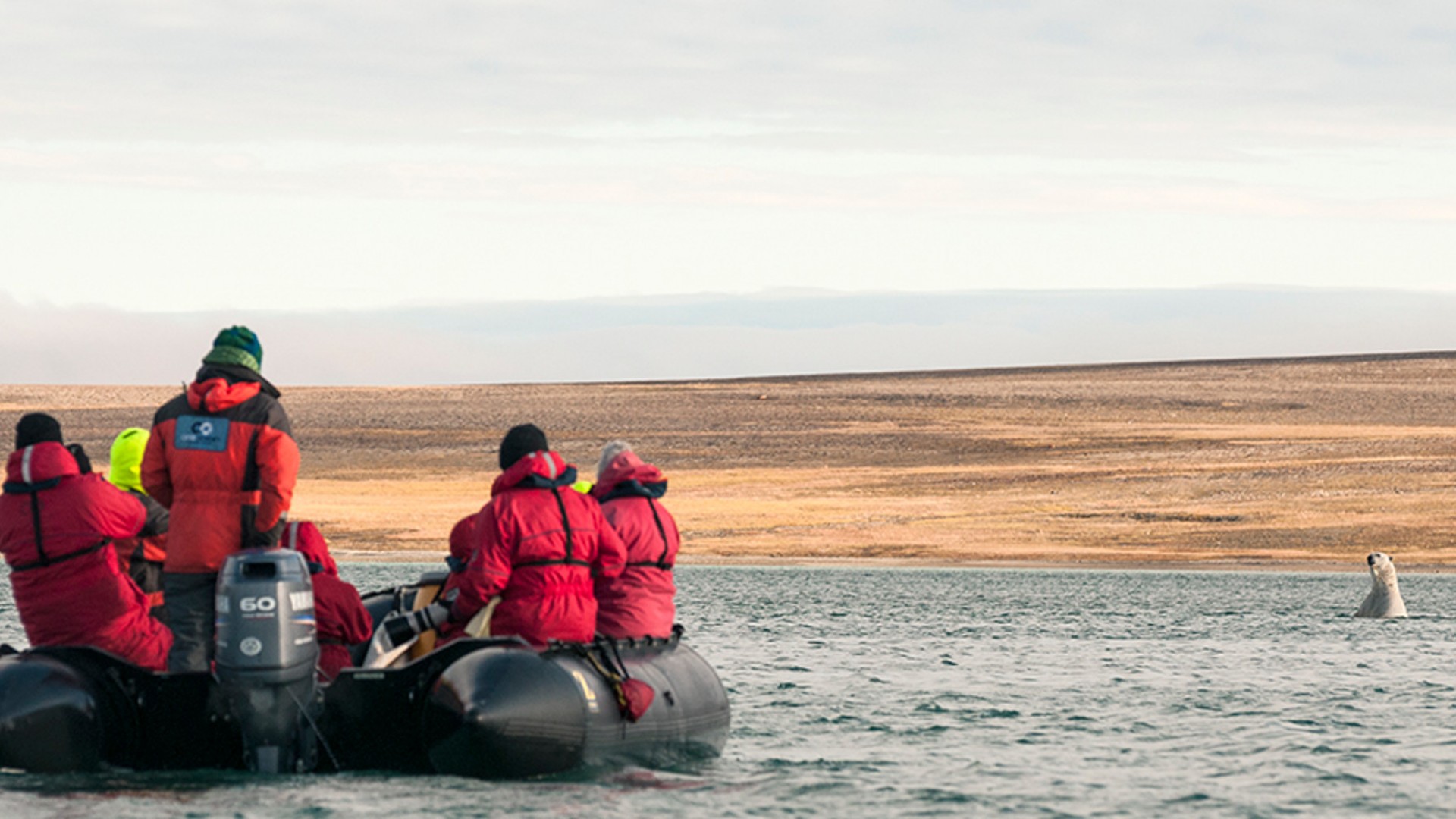
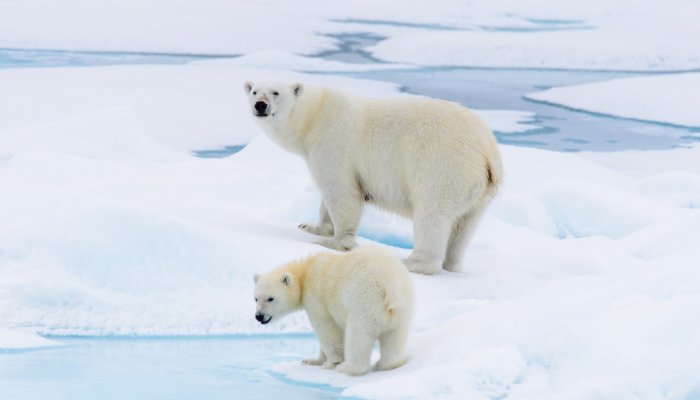
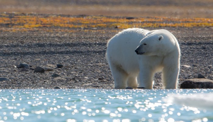
POLAR BEAR
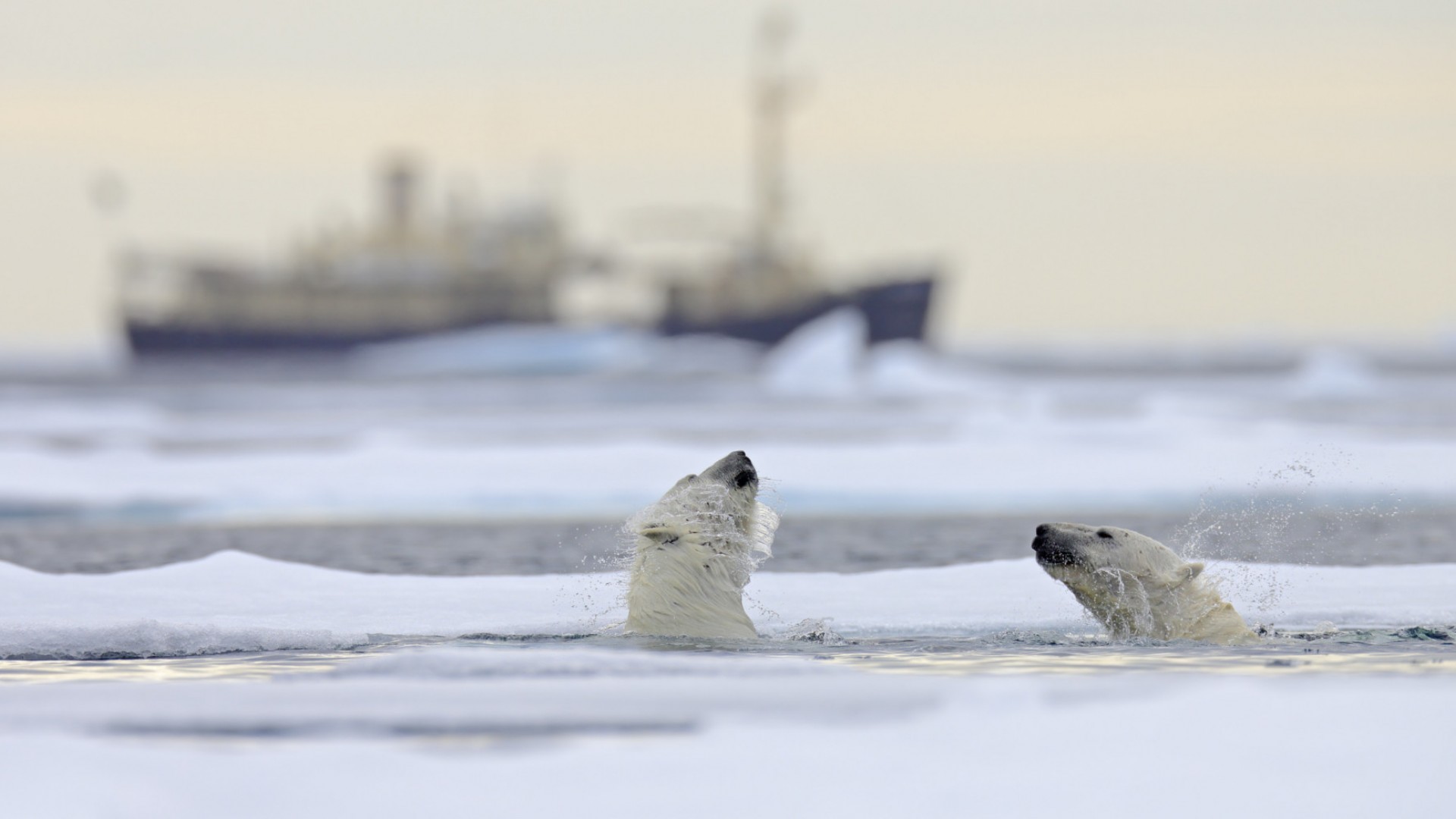
You might be wondering if we’ve messed up placing polar bears under “marine life,” but these bears are definitely marine mammals and a half-aquatic animal. Even their latin name, Ursus maritimus, translates to “maritime bear.” They are indeed well-adapted for surviving not just the Arctic’s ice sheets but the Arctic Ocean. With a thick layer of blubber provides both insulation and buoyancy, water-repelling fur, and oar-like and webbed front paws, polar bears are incredibly strong swimmers sometimes seen swimming hundreds of miles from land masses (though, they most likely hopped on a floating ice sheet to traverse some of that distance). To make it on the chilly surface, polar bears are also equipped with fur on the bottom of their paws to better grip the ice as well as black skin to better soak up the warm sun.
Polar bears are impressively powerful predators with no natural enemies in the Arctic. They enjoy preying on seals who pop up for a bit of fresh air in cracks of ice, breathing holes or the edges of ice fields.
STELLAR SEA LION
Weighing in up to 2,500 pounds, the Stellar may be the biggest sea lion out there. The bull males really take the weight cake, however, as they can reach up to three times the size of an average female Stellar. And unlike other “true seals”—looking at you, elephant seals and harbor seals—sea lions have rotating hind flippers and longer front flippers, allowing them to better move on land.
Stellar sea lions congregate en masse to breed, and it’s definitely a thundering spectacle. Bulls become so focused on gaining territory to impress a mate, young Stellar pups can be trampled in the throng.
Social animals, Stellar sea lions don’t simply gather together to breed; rather, they enjoy some reunions throughout the year.
FUN FACT: While sea lions largely feast on octopus, squid, and fish, they have been known to indulge in some cannibalism and snack on some smaller seals.
HOODED SEALS
Hooded seals get their name from the inflatable hood, or crest, that sits on an adult male’s forehead. Of course, this inflatable hood generally resembles a hot-pink balloon used by the males to demonstrate their manliness to available females—and scare off other males. With most adult males hitting around 9 feet, 900 pounds, skirmishes could do quite a bit of damage. So males flaunt their big, rosy balloons as a way to outmatch their competitors and win the lady.
Unlike bearded seals who prefer shallow waters, hooded seals favor the deeper waters of the North Atlantic and Arctic Oceans. However, they’ve been known to make it as far south as the Caribbean when it’s not breeding season.
Other
MUSK OX
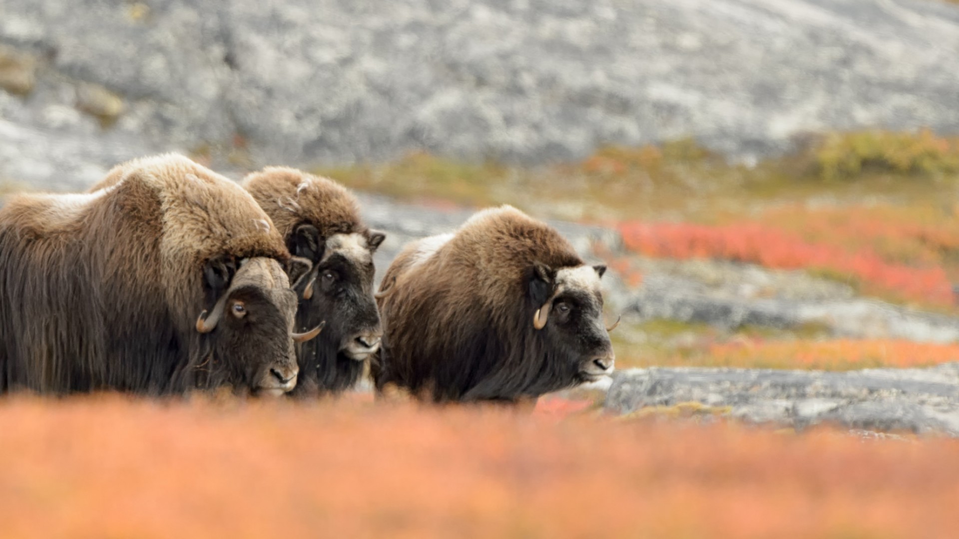
The shaggy haired, lumbering musk oxen have lived in the Arctic for several thousand years, roaming the tundra and munching on lichens, roots and mosses. They are covered with a long, bushy outer coat of hair, called guard hair, that reaches almost to the ground—concealing an additional short undercoat that provides extra insulation in winter but falls out in warmer summer weather. Along with the yaks in Asia, the musk ox have longer fur than any other animal in the world. Underneath their shaggy hair, musk ox have a prominent bony plate lining their forehead and a distinct shoulder hump. Herds of musk ox can reach up to 3 dozen animals—and are sometimes led by a sole female.
FUN FACT: When grey wolves take on musk ox, the herds are quick to respond with a “circle the wagon” defensive strategy. The hungry wolves are met with a tight wall of horns and foreheads while the young oxen remain safe in the middle.
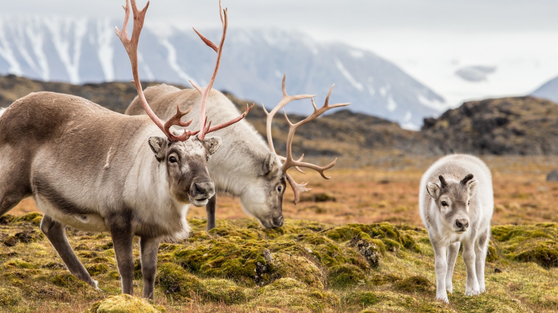
CARIBOU
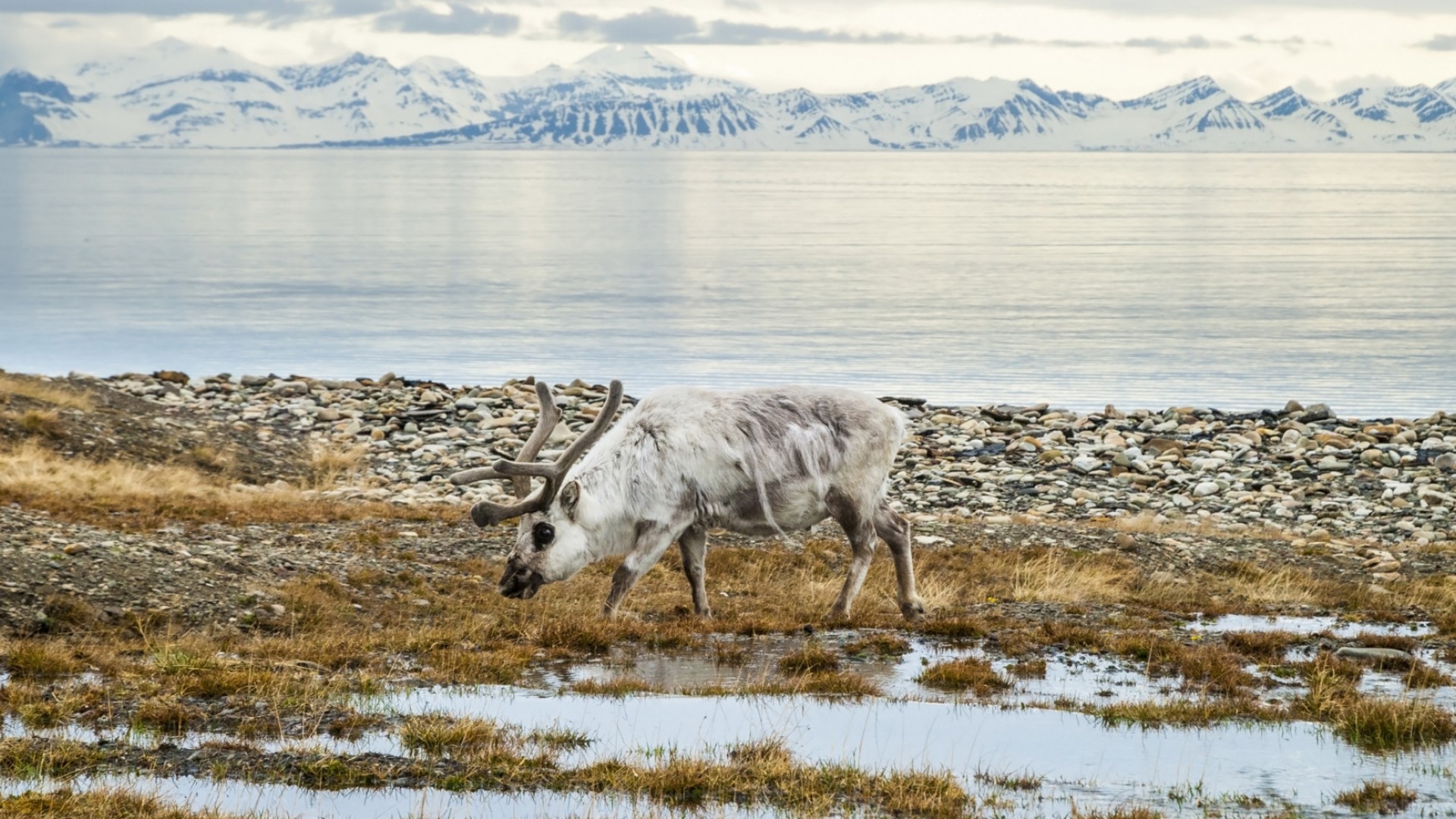
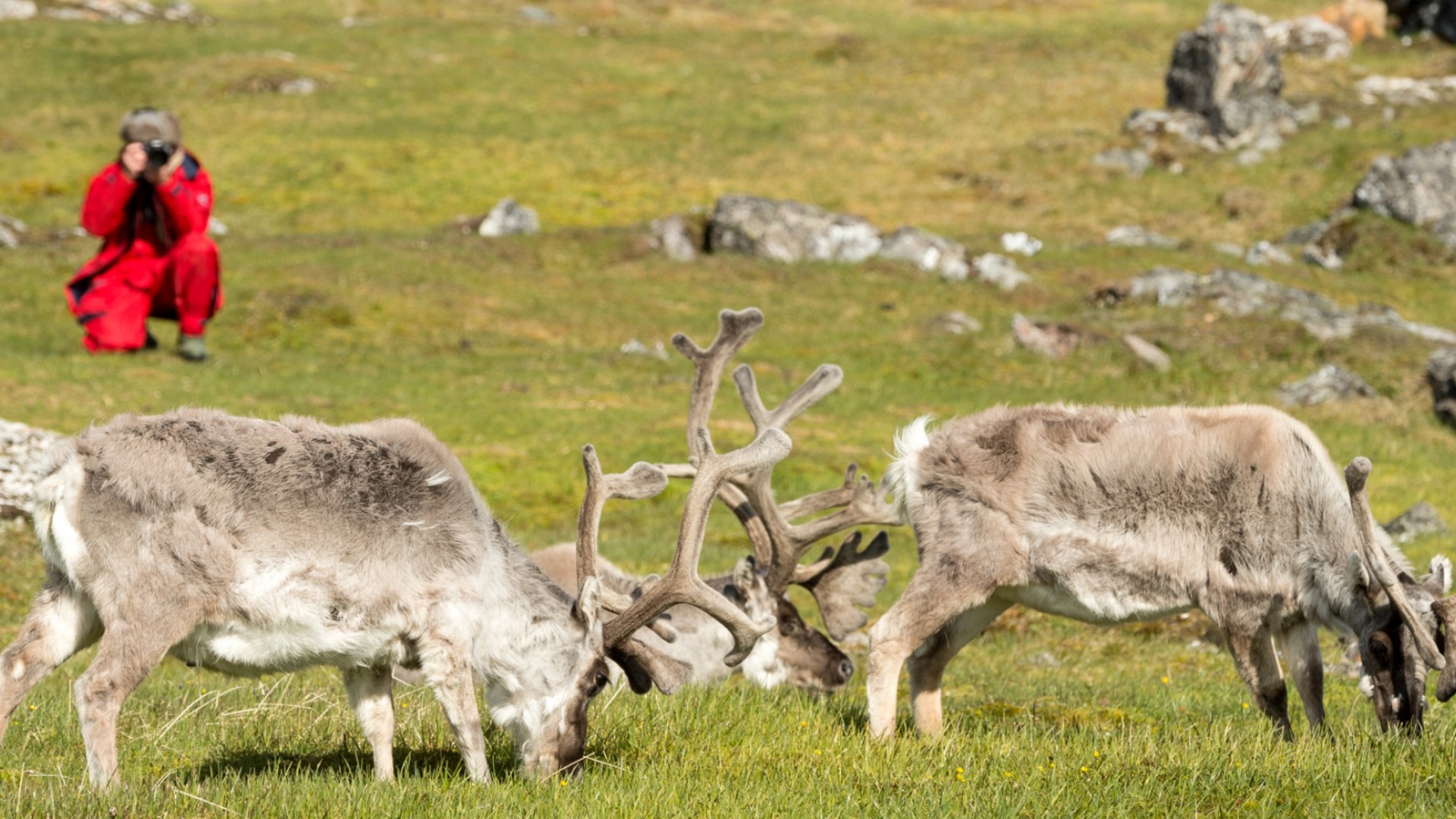
Caribou—or the jolly man at the North Pole’s domesticated reindeer—live in the Arctic tundra regions and subarctic boreal forests. Caribou travel around 1,600 miles every year as they winter in sheltered, southern climates and summer up in the Arctic tundra’s northern climes. Considering the Arctic’s extensive geographical sprawl, it’s hardly surprising then that caribou take on the longest land migration in North America—and they can’t even fly.
Caribou’s massive hooves prove incredibly useful for their nomadic lifestyle. Not only can their hooves’ wide breadth support the large animal’s bulk on snow, they also prove to be effective paddles when swimming in water. The hoof is also equipped with sharp edges that help the caribou find purchase on slick ice or rocks when traveling, and the hollowed-out underside allows the caribou to scoop through snow in search of food.
FUN FACT: Caribou are the only deer in which both the male and female grow antlers.
ARCTIC HARE
The arctic hare is another animal that’s adapted to the harsh environment of the Arctic tundra. Their shortened ears, thick fur and low surface area to volume ratio helps the fluffy creatures conserve body heat. Their physiological appearance changes as well. In the summer, the arctic hare’s coat is blue-gray to match the vegetation and rocks, but in the winter they don a stunning white coat to camouflage in with the world of snow and ice.
As herbivores, arctic hares can also struggle to find food sources, and their long claws serve as useful tools to dig through packed snow and packed, frozen earth in search of food. Of course, they also prove useful when the arctic hares burrow into the snow for warmth.
FUN FACT: You’d think that arctic hares would have more reason than their southern buddies to hibernate, but they don’t hibernate at all through the chilliest months.
ARCTIC WOLF
Arctic wolves, also known as Melville Island Wolves, brave the Arctic’s freezing temperatures with their especially adapted bodies. Arctic wolves have two layers of fur as well as shorter muzzles, shorter legs, a bulkier physique and smaller, more rounded ears than their fellow gray wolf subspecies—all of which ensure excellent insulation and reduced heat loss. Their white pelts also help them blend into the snowy Arctic habitat.
Arctic wolves can be found in the north and eastern coastal regions of Greenland as well as the northernmost regions of North America. As a result of the meager amount of prey available in the Arctic, arctic wolf packs can occupy territories of 1,000 square miles or more—a much greater territory than the wolves down south. In this vast territory, arctic wolves can sometimes cover up to 40 miles a day—traveling over ten hours— in search of caribou, musk oxen, arctic hare, lemmings, seals, ptarmigan and other passing birds on which to feast. It’s a good thing that the wolves can reach the speed of 40 miles per hour.
WOOD FROG
Wood frogs are the only frog that lives north of the Arctic Circle, though they can be found down in Alabama and Idaho. Coming in various shades of red and brown, most wood frogs can be identified by the black marking covering their eyes much resembling a robber’s mask.
Wood frogs have a unique adaptation to the Arctic’s frigid temperatures: freezing themselves. During the winter, the wood frogs cease breathing and their hearts cease beating. At the same time, their bodies produce a unique antifreeze that stops ice from freezing within she cells, though ice can form between the cells. Then the weather warms up, the frogs thaw out.
Fun Fact: Beyond their amazing heart-stopping capabilities, wood frogs may be among the amphibians best able to identify their family members. As tadpoles, siblings have been known to find one another and remain in family groups.
BROWN/COLLARED LEMMINGS
Both brown and collared lemmings are some tough rodents built to survive chilly Arctic conditions.
Brown lemmings tend to be chunkier with fluffy, reddish brown or tawny fur, though their winter coat is grayer and longer. Brown lemmings tend to prefer damp, marshy ground, whereas collared lemmings tend to avoid it. Similarly unlike brown lemmings—or true lemmings—collared lemmings aren’t actual lemmings, but rather belong to the vole family. The petite rodents are well-adapted to the High Arctic and Ungava Peninsula, where brown lemmings don’t tread, with their short tails and small ears as well as their seasonal coat: brown or gray in the summer, and white in the winter. They get their name from the collar of light brown fur that circles their neck.
FUN FACT: During the winter, collared lemmings burrow deep in the snow. However, these are no bare burrows. Rather, they have nest rooms, bathrooms, and sleeping rooms.
Flora
While it may first appear that the Arctic supports very little vegetation and could be considered a polar desert, there’s actually plant life consistently present throughout the Arctic. Crustaceous lichens grow on exposed rock surfaces, and algae grows on permanent ice formations. Larger plants can grow in rock crevices and even grow in patches of grass in plots of soil.
Whatever the Arctic vegetation, they must content with a severe environment consisting of constant daylight in summer, low temperatures, occasionally mobile soil, frozen ground, and harsh winds and snowfall. As such, many of the surviving species grow in compact sizes and groups, cushioned against the climate. They also have a short growing season and rapid life cycle, with spring shoots often showing when frosts still occur and snow remains on the ground and the flowering and seed stages following in short succession.
VEGETATIVE ZONES
The Arctic has two primary vegetative zones: the subarctic zone in the south, formed by the circumpolar boreal forest, and the Arctic proper zone in the north, where the vegetative zone is commonly known as the tundra. The Arctic proper zone and subarctic zone are divided by the tree line.
Various tree species can be found across the polar tree line, or timberline. In northwestern Canada and Alaska, the tree line is primarily comprised of white spruce and extends from the Alaskan Brooks Range to the Mackenzie River delta before curving southeast toward James Bay and Churchill. The Labrador-Quebec tree line largely supports black spruce and some larch. The tree line in Siberia and northern Europe is largely formed by fir, pine, and larch.
TUNDRA
Vegetation of various sorts largely coats Arctic tundra, with different tundra plant communities distinguished across the polar landscape.
- Heath tundra, comprised of some flowering plants as well as lichens and mosses, grows in the better-drained soil and drier regions.
- Tundra grassland grows in a similar environment to heath tundra, but it can largely be found westward of Hudson Bay.
- Hillock or tussock tundra, comprised of dwarf birch and willow as well as grasses and sedges, grows on the northern Alaskan plain where more moisture can be found.
- Subarctic forest-tundra grows south of the tree line and contain galeria forests, where coniferous species such as birch grow.
In warmer Arctic regions, south-facing slopes and circumpolar fields, woody dwarf shrubs, alder, juniper, willow and birch can be found.
FLOWERS
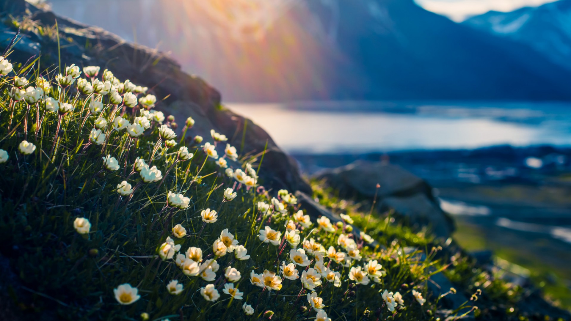
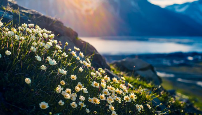
Flowers can suddenly bloom in the Arctic, especially along the southern reaches of the tundra, and carpet the barren ground in colorful vegetation. There are many species, but visitors to the western North American Arctic can generally find wild crocus, arctic poppy, blue-spiked lupine, mountain avens and saxifrage.
FUN FACT: Some larger black lichen, known as “rock tripe,” are edible and eaten by starving explorers in earlier Arctic exploration.
Conservation
The Arctic may be one of the most ecologically significant and productive places on earth, yet the Arctic environment remains vulnerable to conservation threats, and the growth of economic activity has given rise to concern of environmental impact. Climate change has already begun reforming the Arctic’s biodiversity and geography. The Arctic’s shrinking sea ice has already had great impact on the Arctic.
As discussed further on our wildlife page, shrinking ice has led to the increased and extended visitation by orca whales, who are better able to navigate the more open waters. The greater amounts of orcas impacts other wildlife lower on the food chain and threatens the role of the polar bear as the top Arctic predator.
Polar bears have even more to worry about, as shrinking sea ice means polar bears have a greater difficulty catching enough seals to make it through their winter fast. Further, the polar bears’ range of habitat has continually drifted south along with the shifting sea ice, bringing them into closer contact with both new prey species and humans.
ENVIRONMENTAL OPPORTUNITIES AND FUTURE CHALLENGES
There are some benefits to the shrinking sea ice, however—for humans. Increased development remains vital to northern communities seeking economic growth. Shipping routes throughout the Northwest Passage have an easier time traveling through open waterways, and the tourism industry also benefits from easier passage.
Moving forward, the Arctic’s conservation future lies in seeking balance between conserving significant ecosystems and creating sustainable economic and energy solutions. Whether that be by supporting renewable energy sources, building sustainable fisheries, working with local communities to protect habitats and reduce the risk of gas and oil developments, or securing protected areas and conservation management programs, there also lies great environmental potential in the Arctic.
CONSERVATION CHALLENGES
One pervasive threat is air pollution. In particular, the Arctic experiences ice fog, where particles and small ice crystals are trapped by the Arctic’s temperature inversion within the lower atmosphere, thus producing a shimmering effect and low visibility.
One continued area of concern has been the damage created by ships. In the past, exploratory or even whaling ships have left behind debris or various detritus; however, these leftovers were largely organic in nature. Now, tankers traversing the Arctic in the course of offshore drilling find themselves faced with the hazard of ice-filled waters. where damage can cause serious environmental damage with oil spills or even sunken nuclear-powered ships. The Exxon Valdez oil spill in 1989 remains a major example of this environmental threat. Over the course of three days, around 11 million gallons of oil gushed into the ocean, killing a multitude of marine and wildlife and causing socio-environmental felt to this day.
Terrestrially, oil and gas fields as well as opencut mining, road building and even heavy vehicle traffic can disrupt the susceptible Arctic environment in ways we may not even know yet.
Geology
ARCTIC GEOLOGY
Over time, the Arctic developed from four core rock shields:
• The Canadian Shield, lying underneath the whole of the Canadian apart from the Queen Elizabeth Islands.
• The Baltic/Scandinavian Shield, which pivots around Finland and includes northern. Scandinavia apart from the Norwegian coast as well as the northwestern region of Russia
• The Angaran Shield, lying between central Siberia’s Lena and Khatanga rivers.
• The Aldan Shield, found in eastern Sibera.
The polar landmasses we see today have shifted in relation to the North Pole as well as to each other over time, transported with shifting tectonic plates. Marine sedimentation throughout the years, largely occurring in between the rock shields, has lent itself to the partial submersion of the shields as well as geologic folding, which produced mountains—many of which have eroded over time.
EARLY GLACIATION
Glaciers and continental-scale ice sheets developed throughout the northern latitudes in early formative periods. Information gathered from the final glaciation occurring 80,000-10,000 years ago indicates that the Atlantic Arctic islands were coated in ice excepting where nunataks—secluded mountain peaks—poked out of the ice shields. The Scandinavian Ice Sheet coated large portions of northern Europe, extending from Russia’s Severnaya Zemlya to the British Isles. While northeastern Siberia appeared to have avoided substantial glaciation during this final period, the region had experienced heavy glaciation during earlier periods.
The massive ice sheets served to carve unique landforms throughout the Arctic and beyond. Finland the the northern Canadian Shield were left with numerous lakes and lowlands filled with glacial deposits, producing more even terrain interspersed with glaciated ridges such as moraines. Higher elevations were similarly marked with U-shaped valleys—many of which can be partially seen near the Arctic coasts where they peak out of the water as fjords. These fjords can best be seen along Canada’s eastern coast, in southern Alaska, on many of the Arctic islands, and around the coastlines of Norway, Greenland and Iceland.
CONTINENTAL UPLIFT AND SUBMERGENCE
As the continental ice sheets’ weight pressed down on the earth’s crust, the sea covered most of the coastal areas. However, as the ice sheets melted, the crust regained its original latitude, leaving elevated strandlines coated with the skeletons of marine life, shells and other detritus.
The Canadian Arctic boasts of some of the highest strandlines, with some reaching 500-900 ft, while the coasts of Labrador and Baffin Bay have lower strandlines. Some lower strandlines, such as those found in the southern and western coasts of Hudson Bay, the elevated beaches form pronounced ridges jutting out of the plains.
While uplift continues throughout the Arctic, especially in northern Canada and northern Sweden, some Arctic coasts—such as those bordering the Beaufort Sea—continue to experience submergence.
FUN FACT: Non-glaciated regions of polar continental shelves found themselves exposed at lower sea levels (such as in the Bering Strait), which led to the migration of people to North America.
ARCTIC GEOGRAPHY
The Arctic covers 14.5 million square km—almost the same size as Antarctica—and consists of the northern regions of Alaska, Canada, Sweden, Iceland, Finland, Russia and Norway as well as the whole of Spitsbergen and Greenland. Despite that massive landmass, the Arctic can be thought of as predominately an ocean encompassed by continents, whereas the much colder Antarctic is predominately a continent encompassed by water. As the Arctic Ocean soaks up so much solar radiation, the overall effect is a much warmer, balmier environment.
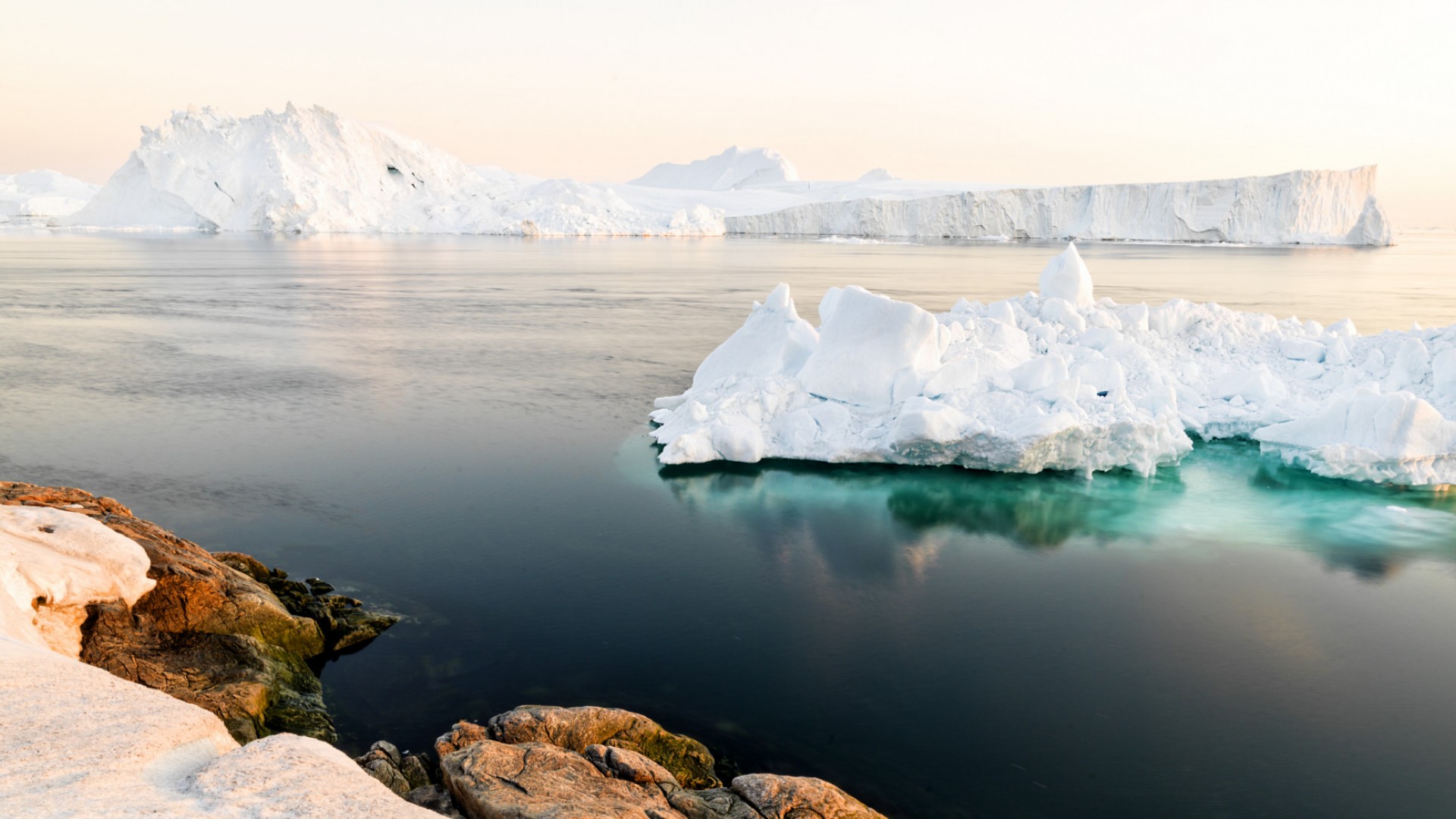
That being said, much of the Arctic’s water is frozen. While frozen freshwater makes up some icebergs and glaciers (about 20% of the world’s supply of freshwater, in fact), most of the Arctic’s water is saltwater found in the Arctic basin.
There are several ways to define the mass of land embraced by the Arctic. One predominate definition is the land north of the Arctic Circle, which is itself defined defined by an imaginary line of latitude that runs at 66 degrees 33 minutes North. North of this latitudinal line, the summer doesn’t set on the summer solstice. For this reason, the Arctic Circle is also known as the “land of the midnight sun.” The Arctic can also be defined as the region where the average July temperature is less than 10°C (50°F). This isothermal boundary also roughly follows the northern tree line, which can serve as another visual boundary.
ARCTIC OCEAN SEAFLOOR
The Arctic Ocean seafloor is divided by three large mountain ranges that run parallel between Siberia and Greenland: the Nansen-Gakkel Ridge, which runs across the northern basin of western Russia to Greenland; Lomonosov Ridge, which sits on average about 10,000 ft high above the abyssal plain; and the Alpha Ridge.
Deep underwater plains, separating the mid-ocean ridges, lie on the Arctic ocean seafloor. The Pole Abyssal Plain separates the Nansen-Gakkel Ridge, while on the Canadian boundary of the Lomonosov Ridge lies the Fletcher and Wrangel Abyssal Plains. Sitting below the Alpha Ridge, north of Canada, lies the Canada Abyssal Plain—the largest of the Arctic sub-basins and a sweeping region with an average depth of 12,000 ft.
TOPOGRAPHY
Various landscapes can be found throughout the Arctic, providing a range of ecosystems as well. Primary topographical features include:
• the massive Greenland ice sheet
• North America’s Brooks mountain range
• the Svalbard archipelago islands
• northern Scandinavia’s fjords
• northern Siberia’s plateaus and river valleys
Travel Essentials
When to Go
Visitors can comfortable travel throughout the Arctic from June to September, though it’s best to take what sort of adventure you’re looking for into consideration. The fall and winter months bring limited sunshine and harsh weather to the Arctic, so unless you’re hoping to catch a glimpse of Santa Claus “in season” at the North Pole or see the Northern Lights, June-September is your best bet.
High summer brings in the best weather for many travelers: days are long, weather is more pleasant and ships can more easily sail further north.
March-May: You can still potentially catch the Northern Lights in March, and plenty of snow abounds through May.
June-September: Receding ice gives further opportunity for traveling north and wildflowers are in bloom. Polar bears, walrus and seals are out and about, and July-September is the best time to see orcas, belugas, humpbacks, and bowheads. There’s plenty of birdlife as well since migratory birds are back on the coastline forming nesting colonies filled with young fledglings. In September, there’s also some chances to see the Northern Lights.
October: This is a good time to see the Aurora Borealis, though this is the last month for many expeditions.
Where to Go
SVALBARD
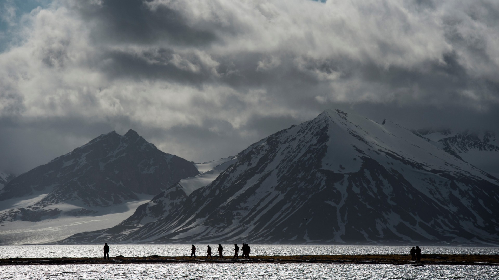
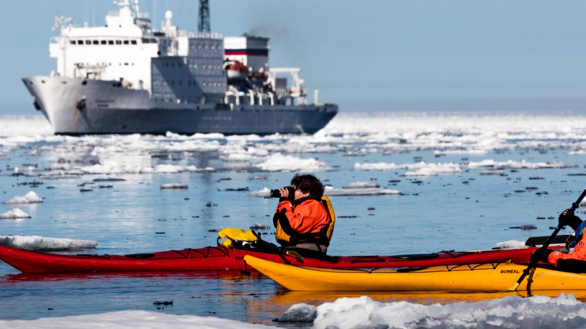
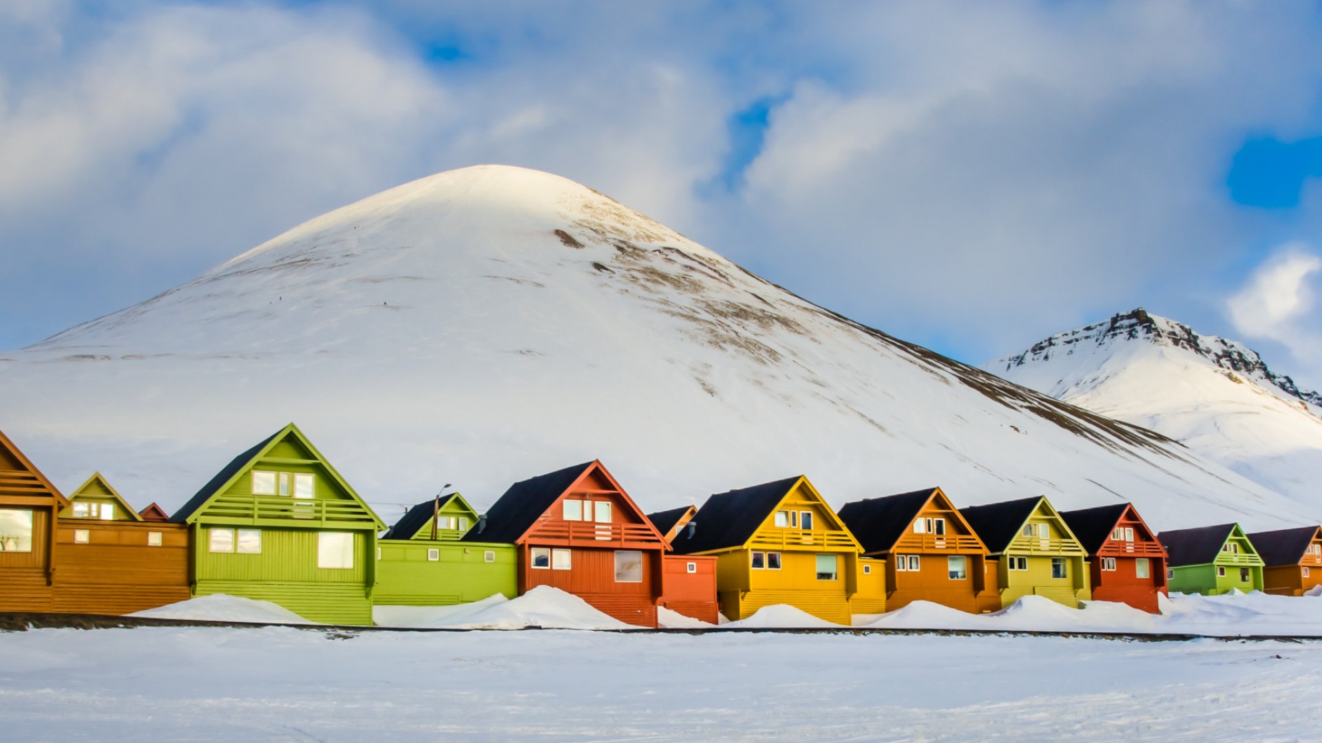
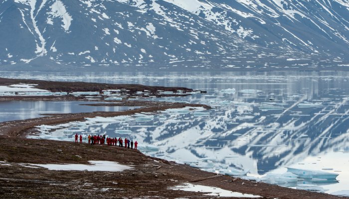
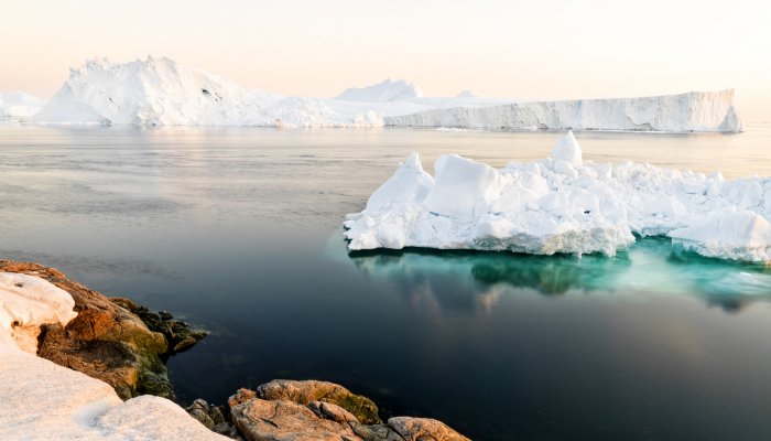
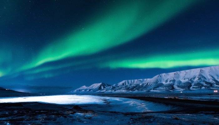
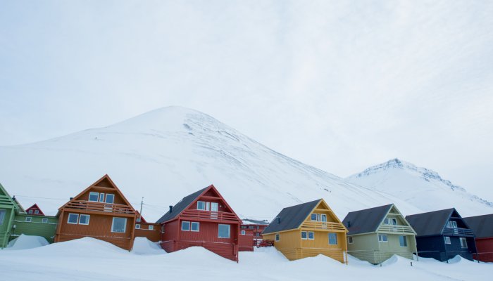
Svalbard’s everything the High Arctic should be: untouched icefields, glittering icebergs and towering snow-swept glaciers. It’s immeasurable Arctic night, unfading summer sunlight. It’s untouched wilderness and epic polar exploration. It’s a distant frontier that takes you out of yourself and into the wild. The archipelago and its point of entry, Longyearbyen, shows you what the Arctic can be at 78° north. That—and it’s one of the best places to see polar bears in their natural habitat. Kayak among icebergs, venture into the fjords and trek the tundra in Svalbard.
NUNAVUT
Nunavut may be Canada’s youngest territory, but it was settled more than 4,000 years ago. Today, it’s steeped in the Inuit culture, crawling with Arctic wildlife and home to sprawling expanses of breathtaking wilderness.
Taking up most of the Canadian Arctic Archipelago, Nunavut is a sprawling Arctic wonderland with plenty of sites to offer. It’s home to the northernmost permanent habitation on earth and many also consider it the gateway to the Arctic.
Popular destinations include the cities of Iqaluit, Pangnirtung, Resolute and Grise Fiord; Sirmilik National Park and Auyuittuq National Park can also be found here.
VICTORY POINT
Victory Point, an otherwise undistinguished spot on King William Island in Nunavut, has gained notoriety in its significant role in unraveling the elusive ate of the Franklin expedition. It was at Victory Point that Frances Leopold McClintock, leading a search party for Franklin, discovered a cairn containing a letter left from earlier search party—a letter indicating 3 cairns standing sentinel at Victory Point. One of the cairns contained two discrete messages from the captain of the HMS Erebus, one of the Franklin expedition ships, detailing both an optimistic send-off for further exploration and the subsequent death of Franklin and abandonment of his ships.
Travelers to Victory Point can expect rocks, caribou and musk ox, and windswept plains, but it’s worthy of a stop simply because it’s where the paper trail of the Franklin Expedition concludes.
FORT ROSS (SOMERSET ISLAND; HUDSON BAY CO TRADING OUTPOST)
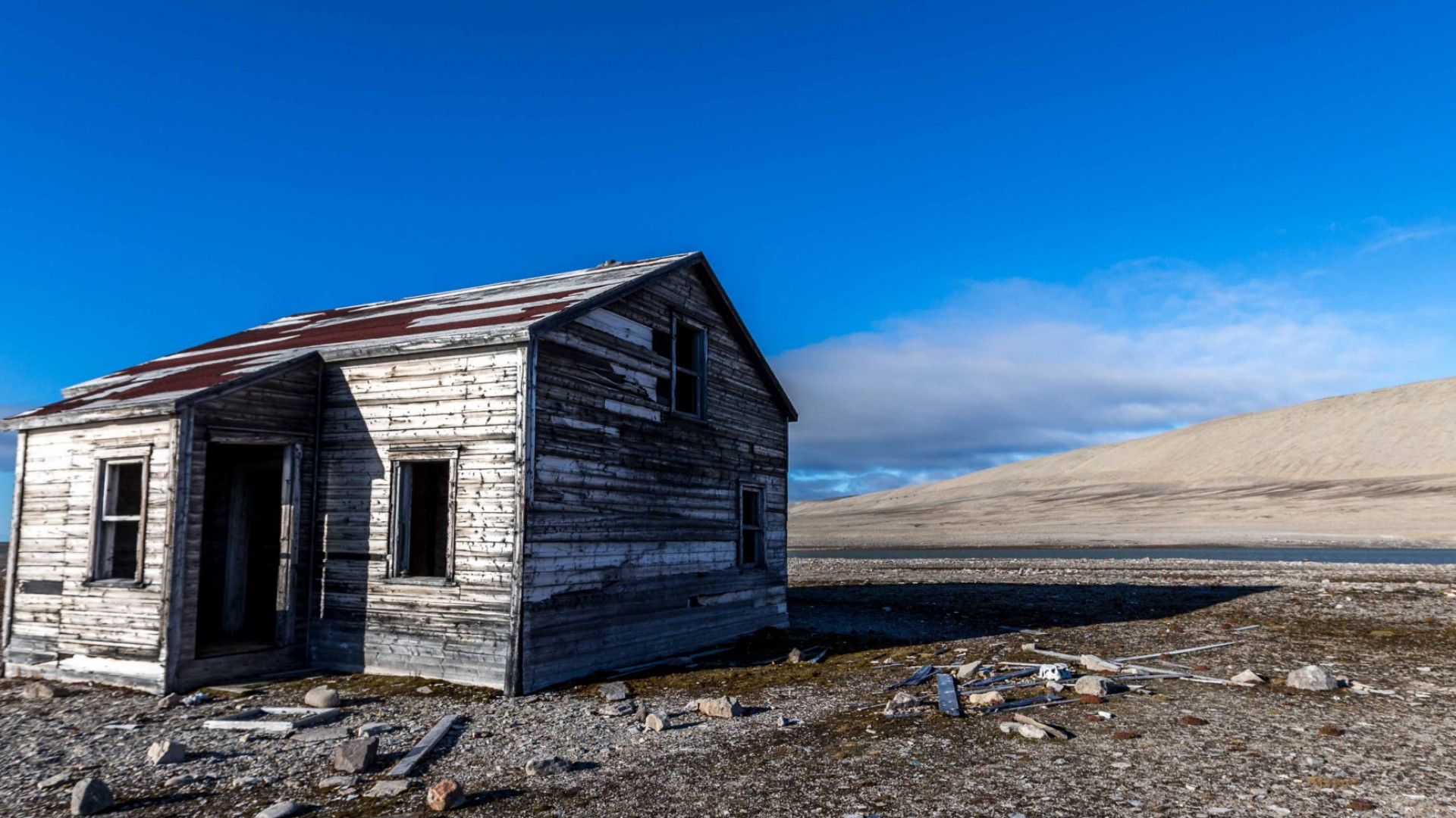
Fort Ross, a Hudson’s Bay Company trading outpost, lies in the southeastern corner of Somerset Island. These days, it’s a prime Arctic hotspot for travelers sailing the Northwest Passage through Bellot Strait. Despite its tourist attraction, Fort Ross doesn’t offer souvenirs alongside its lonesome views of deserted clapboard buildings. Instead, its primary draw lies in its association with the ill-fated Sir John Franklin expedition.
Frances Leopold McClintock, hired by Lady Jane Franklin to search for her husband, sailed up Bellot Strait and settled into what became Depot Bay, eventually discovering evidence regarding the downfall of the Franklin expedition.
The outpost itself—the first east-west trading post through the strait constructed in 1937—was only operational for about 11 years before it was shut down due to declarations that the severe ice made it both difficult to access and inefficient.
Visitors can walk up to McClintock’s cairn and monument, the outpost’s weather-worn buildings, still-used storehouse and a small house filled with former essentials neighboring four unmarked graves.
BEECHEY ISLAND
Beechey Island, a National Historic Site of Canada, remains a favorite landing for travelers to Canada’s high Arctic. Beechey Island, part of Nunavut’s Arctic archipelago, is not actually an island at all, but a peninsula attached to Devon Island. Stepping foot on Beechey Island takes one back into history, into the era of Arctic exploration.
Captain William Edward Parry was Beechey Island’s first European visitor in 1819, and Franklin and his crew stopped by in 1845 on their ill-fated journey. You can even see the gravestones of 3 of Franklin’s crew on the island. Beyond Parry and Franklin, many explorers wintered on Beechey Island over the years, drawn by its smooth topography and small hill providing some shelter. After Franklin’s disappearance, Beechey Island was also used as a base-point and supply depot for the search parties.
When stopping by Beechey Island, look for the Franklin expedition’s wintering camp, the Northumberland House supply depot used after Franklin’s disappearance, two message cairns, the HMS Breadalbane site where the British ship went down, and the Devon Island site located at Cape Riley.
LANCASTER SOUND
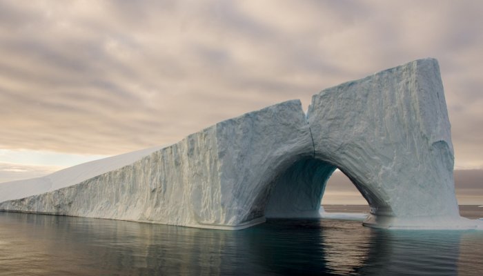
Lancaster Sound, otherwise known as Tallurutiup Imanga, is the Arctic’s wildlife superhighway located right at the Northwest Passage’s eastern entrance. Lancaster Sound is not only rich in biodiversity; many consider it the “ecological engine” of the Canadian Arctic’s eastern marine ecosystem. Upwelling of nutrient-rich waters and present of polynyas (areas of open water surrounded by ice pack) make this region ideal for marine mammals and birds. And truly, Lancaster Sound’s referred to as a “superhighway” because it serves as a significant east-to-west migratory corridor running from Baffin Bay to the Arctic Archipelago. Many species traverse the region as they travel from their winter to summer habitats.
If you’re hoping to catch a look at Arctic wildlife, Lancaster Sound should be on your list. Up to 75% of the global narwhal population can be found here and up to 20% of the Canadian beluga population can be found here. 6,500 bowhead whales swim through Lancaster Sound per year. It’s also home to some of the Canadian Arctic’s largest seabird colonies as well as Canada’s largest subpopulation of polar bears.
Recently, Lancaster Sound also became the Canada’s largest national marine conservation area area—the final boundary protection the region from future offshore oil and gas exploration. The conservation area will not only protect the significant ecological region as well as the rich Inuit heritage that has thrived there far back into history.
HEALTH AND SAFETY
VACCINES
No vaccinations are required for traveling to the polar regions of the Antarctic or Arctic. However, the Center for Disease Control and Prevention (CDC) advises that travelers should be up-to-date on routine vaccinations. The CDC also advises the following inoculations for visiting many of polar region’s gateway countries: yellow fever, hepatitis A and B, typhoid, rabies.
Please check with the CDC’s website to find out more health information pertaining to individual countries.
TRAVEL INSURANCE
Taking out travel insurance before setting off on your adventure protects against injury, illness, loss, theft and more. While travel insurance policies cover problems such as loss of baggage, tickets and cancellations, many exclude activities considered as “dangerous sports” unless you pay an additional premium. Make sure that your travel insurance covers the range of activities you may be participating in, such as as kayaking, as well as emergency evacuation. While ships provide basic medical supplies and on-board physicians, serious treatment necessitates evacuation.
As always, keep receipts for any medical treatment and medicines you receive while traveling. and obtain a statement from the police if later need to make a claim.
SEA SICKNESS
As travelers spend much of their time in the Arctic and Antarctic at sea, seasickness is a common symptom. Consider the best remedies for you, such as wristbands, medication, patches or ginger.
ZIKA VIRUS
The CDC has reported Zika outbreaks in Argentina and advises travelers to practice appropriate precautions. Check out the CDC's website for updated travel alerts, and please review our prepared Zika Virus Travel Tips on the Health & Safety dropdown menu to help you travel healthy.
SUN EXPOSURE
While the cold may be deceiving, the sun’s harsh rays can be made more intense as they reflect off of snow, ice and water. Protective sunglasses and sunscreen go a long way toward keeping your skin safe from sun exposure.
PHYSICAL REQUIREMENTS
Preparing your body for the activities awaiting you and being in good physical shape go a long way toward enjoying your polar adventure. Activities such as trekking, kayaking and boarding zodiacs can be physically taxing, so preparing your body and being in shape is highly recommended.
SAFETY TIPS
Make sure to pay attention to your guides’ safety orientations. The environment and the wildlife can be fierce, so stay with your group and don’t approach wildlife. Also, seasons can change
quickly throughout the Arctic, so pack additional layers.
ENTRY REQUIREMENTS FOR ARCTIC & GATEWAY COUNTRIES
Different gateway countries have different entry requirements depending on the traveler’s citizenship or country of residence, so it’s always helpful to check with each country’s embassy for the most up-to-date visa requirements. That being said, all countries require travelers to have a passport valid for at least 6 months after your trip ends. Here are some other entry requirements for major Arctic gateway countries:
CANADA:
- Passports: Most international travelers require a passport to enter Canada. U.S. citizens at land and sea borders have other options, such as an enhanced driver's license, permanent resident card or NEXUS card. To further check out approved identification documents, check with the Canada Border Services (www.cbsa-asfc.gc.ca).
- Visas: Visitors from certain countries require a visa to enter Canada. Travelers who do not require a visa, with the exception of U.S. citizens, require an Electronic Travel Authorization. Travelers must apply for an eTA before traveling.
ICELAND: A Schengen country, Iceland requires a valid passport and return ticket but no visa for American and Canadian travelers as well as others for a temporary stay less than 90 days. Check with the Directorate of Immigration for more information on who does and does not need a visa.
FINLAND: As another Schengen country, U.S. citizens require a valid passport but do not require a visa for a visit for up to 90 days.
SWEDEN: Another Schengen country, Canadian and American citizens require a valid passport but do not require a visa for a visit for up to 90 days.
GREENLAND & DENMARK: Greenland the the surrounding Faroe Islands are not party to the Schengen Agreement, but to visit Greenland and the Arctic beyond, you’ll enter Denmark—a Schengen country. To visit Greenland, Canadian and American citizens a passport valid for at least 6 months beyond your stay in Greenland and return ticket are required, but they do not require a visa for stays up to 90 days.
NORWAY/SPITSBERGEN: Norway is party to the Schengen agreement, so the same visa and passport rules of Sweden, Iceland, Denmark, and Finland apply. That being said, the Svalbard region consisting of several major and minor islands standing between Norway and the North Pole are excluded to the Schengen agreement.
RUSSIA: U.S. citizens require a valid U.S. passport and valid entry and exit visas issued by the Russian Consulate or Embassy. There are different types of Russian visas, so it’s important to check with your country’s Russian embassy to obtain the appropriate visas in well in advance of your travels.
CURRENCIES IN ARCTIC & GATEWAY COUNTRIES
CANADA: The Canadian dollar is Canada’s official currency, and the U.S. dollar is accepted in many major Canadian cities. You may hear of the Canadian dollar as a loonie—a one dollar coin—while a toonie is a two dollar coin.
- Exchanging Money: Many stores will exchange U.S. dollars for Canadian dollars, but banks offer better exchange rates.
- Credit Cards and ATMs: Credit cards are widely accepted throughout Canada. If you wish to use a debit card, it’s easiest to use one issued by a Canadian bank, as only these will be widely accepted by stores and ATMs.
ICELAND: The króna is Iceland’s official currency, and all major currencies can be exchanged at banks and airports upon arrival. Visa and Mastercard are widely accepted throughout Iceland as well.
FINLAND: The Euro is Finland’s official currency. Keep in mind that banks are only open on weekdays, though ATMs can be found in most locations. Major credit cards are also widely accepted.
NORWAY/SPITSBERGEN: The Kroner is Norway’s official currency, though the country largely depends on credit and debit cards. Visa and Mastercard are the most commonly accepted credit cards, though some supermarkets may only accept debit cards. If you hope to exchange currency, look for the Norwegian bank Forex.
SWEDEN: The Swedish Kronor is Sweden’s official currency. Credit cards are widely accepted, and if you hope to stock up on Swedish Kronors you can stop by an exchange office or an ATM to withdraw local currency.
RUSSIA: The Ruble is Russia’s official currency, and neither the Euro or the U.S. dollar are accepted as legal tender in Russia. Local currency is used much more frequently than credit cards, and while you’ll find places to exchange money throughout Russia, the larger cities have the better rates. ATMs are also common in larger cities.
Getting There
Several countries serve as gateways to the Arctic, depending on which part of the Arctic you wish to visit: Canada, Iceland, Finland, Norway/Spitsbergen, Sweden, and Russia. Check out which city your Arctic tour departs from to further determine the best way to get there.
Weather: When to Go
ARCTIC CLIMATE
The Arctic climate can vary greatly as it depends on topography, elevation, proximity to the sea, and elevation. Despite those factors, the wealth of the Arctic shares some polar characteristics such as limited solar energy during the summer due to high latitudes.
While you’ll often see the polar climates divided into two large groups, those belonging to the ice caps and those belonging to the tundra, it’s more helpful to divide them up as polar maritime climates. As such, classifications include:
- The maritime Arctic including the northern Arctic islands and the contiguous coasts of the Pacific and Atlantic oceans, where the snowfall is high while the winter temperatures are incredibly low.
- The polar continental climates in Canada, northern Alaska and Siberia where the snowfall is light and winters are extremely cold.
- Included in this classification is the Canadian Arctic Archipelago, whose climate is buffered during the winter by its thick sea ice.
- Transitional zones such as the polar basin, subarctic climates, the southern region of the tree line and the limited regions of ice climates (such as Greenland).
In the polar continental climates, winter hits early in the far north—around the end of August—and around the end of September south toward the tree line. Temperatures drop rapidly from August to December, evening out from January-March with average temperatures reaching around −30 to -20 °F in the North American Arctic and -35 °C in the central Siberian Arctic. For the most part, the polar continental climate remains relatively calm during the winter, with long stretches of low snowfall and clear skies.
In contrast, summer temperatures remain more consistent across the whole of the Arctic. In the polar continental climates, central continental regions generally experience calm weather and long periods of sunshine concluding in thunderstorms.
In the maritime Arctic, winter brings in long periods of strong winds, heavy precipitation and storminess despite its moderate temperatures. During the summer, the weather remains somewhat cool, with prominent fog and low-lying clouds.
In the subarctic, south of the tree line, there’s a significant difference between the continental regions (found in Alaska, the interior Yukon and the Mackenzie Basin) and the oceanic regions (such as northern Russia, northern Scandinavia and northern Quebec-Labrador). While the continental regions experience high precipitation and temperatures during the summer, the oceanic regions experience lower summer temperatures and higher precipitation in the fall.
The polar basin and its central polar ocean have winter conditions comparable to northern Alaska or northeastern Siberia while summer temperatures can rise over 34 °F—usually accompanied by continuous fog.
FUN FACT: In the Arctic, it’s much better to assess temperatures by windchill, which usually at its chilliest north of Hudson Bay where low air temperatures combine with strong northwest winds


