Top 5 Hiking Trails in Europe
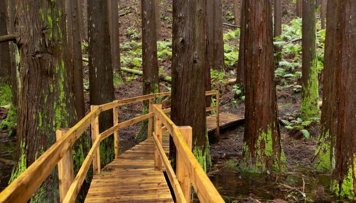
While we often associate Europe with its historic cities and cultural riches, it’s also home to some remarkable landscapes and hiking trails. From the soaring peaks of the Alps to the rugged coastlines of the Mediterranean, this diverse continent boasts incredible scenery that is best explored on foot.
Europe’s hiking trails offer a unique opportunity to immerse yourself in the continent’s stunning natural beauty and experience its rich cultural heritage at a slower pace. Not only do they take in jaw-dropping vistas but remote villages where long-established traditions remain strong.
With over 40 countries to choose from, 10 major mountain ranges, and more than 500 national parks, Europe offers endless opportunities for adventure and discovery. Whether you’re a seasoned trekker or a casual walker, these incredible hikes are sure to leave a big impression.

Peaks of the Balkans (Albania, Kosovo, and Montenegro)
Distance: 119 miles/192 kilometers
The Peaks of the Balkans is a 192-kilometer hiking route that winds through the remote and rugged mountains spanning the borders of Albania, Kosovo, and Montenegro. This groundbreaking trail, the first of its kind in the Western Balkans region, follows ancient paths and shepherds’ tracks that for centuries have connected isolated villages and alpine valleys.
Jointly developed by the three countries with support from the German Development Agency, the trail was established to promote tourism and support local communities in an area that had long been divided by conflict and political tensions, especially during the Cold War period. The circuit trail traverses a diverse array of landscapes, from fertile valleys dotted with traditional stone villages to stark rocky plateaus and mountain peaks reaching over 2,500 meters in height.
Along the way, hikers get to experience the warm hospitality and cultural traditions of the Balkan people, with opportunities to stay in family-run guesthouses, taste homemade traditional cuisine, and witness timeless pastoral lifestyles. While the hiking is only moderately difficult, the Peaks of the Balkans still requires good physical fitness to complete the 10-13 day journey.

Camino de Santiago (Spain)
Distance: 100 to 500+ miles/160 to 800+ kilometers
The Camino de Santiago, also known as the Way of St. James, is an extensive network of ancient pilgrimage routes that culminate at the tomb of St. James the Apostle (within the Cathedral of Santiago de Compostela) in northwestern Spain. As Europe’s oldest and most renowned pilgrimage, the Camino attracts hundreds of thousands of pilgrims and hikers each year who embark on a journey of spiritual growth, self-discovery, and immersion in Spanish culture and history.
The routes, which can span anywhere from 100 to over 500 miles, wind through medieval villages, historic cities, and the picturesque valleys of the Pyrenees mountains. Some of the most popular routes include the Camino Francés (the French Way), which stretches nearly 500 miles from St. Jean-Pied-du-Port near the French border; the Camino Portugués (starting in Lisbon or Porto); the Camino del Norte (which follows Spain’s northern coast); and the Original Way or Camino Primitivo, which dates back to the 9th century.
Regardless of the path chosen, all pilgrims carry a credential or “pilgrim’s passport” that is stamped along the way, share a greeting of “Buen Camino!” and end their journey at the magnificent Cathedral in Santiago where they attend the Pilgrim's Mass. More than just a long-distance hike, the Camino offers a chance to disconnect from the stresses of modern life, meet fellow pilgrims from around the world, and experience the warm hospitality and cultural traditions of northern Spain.

The Lycian Way (Turkey)
Distance: 335 miles/540 kilometers
Exploring the ancient Anatolian region of Lycia, the Lycian Way is a long-distance hiking trail that winds its way through the breathtaking coastal scenery of southwestern Turkey. Stretching approximately 335 miles (540 kilometers), this well-marked trail takes hikers from the picturesque village of Hisarönü near Fethiye to the town of Geyikbayırı, which lies around 20 kilometers from the bustling city of Antalya.
The trail, conceived by Briton Kate Clow, pays homage to the fascinating civilization that once flourished in this region. Along the way, trekkers have the opportunity to explore not only spectacular coastal landscapes but also the remnants of the ancient Lycian civilization. These include rock-cut tombs and sarcophagi adorning cliff walls, which serve as a testament to the ingenuity and craftsmanship of this long-lost culture.
The Lycian Way is Turkey’s first long-distance walking route and opened to hikers in 1999, with the iconic red and white stripes of the Grande Randonnée (GR) footpath convention guiding the way. It can be completed in around 20 days, although many opt to hike just a section over the course of a week, with stops to explore the ancient ruins of Olympos and the sunken city of Simena.

GR20 Trail (Corsica)
Distance: 112 miles/180 kilometers
The GR20 is a challenging long-distance hiking trail that snakes its way across the mountainous interior of Corsica. Stretching approximately 112 miles (180 kilometers) from Calenzana in the north to Conca in the south, the GR20 follows the granite spine of mountains that splits the island in two. Many of the peaks here soar to over 6,500 feet (2,000 meters)!
With around 39,370 ft (12,000m) of elevation gain and loss over its length, the GR20 throws constant challenges at hikers and is considered one of the toughest and most technical GR routes. From steep, rocky ascents (and descents) in the north to exposed, knife-edge ridges in the south, this is not for the inexperienced. But the views across Corsica are more than worth it!
Most hikers take around 15 days to complete the full route, depending on fitness levels and weather conditions. Along the way, basic lodging is available in mountain refuges, where you can sleep either in the refuge or pitch your tent nearby (wild camping along the trail is prohibited). The midpoint of Vizzavona, with its train station, divides the GR20 into two distinct sections and provides a convenient starting or ending point for those tackling only half of this epic trek.

Via Dinarica (Slovenia, Croatia, Bosnia and Herzegovina, Montenegro, Kosovo, and Albania)
Distance: 780 miles/1,260 kilometers
The Via Dinarica is an extensive network of long-distance hiking trails that wind their way through the Dinaric Alps, a spectacular mountain range that spans seven countries in the Western Balkans region. Launched in 2010 with the goal of boosting tourism and showcasing the natural beauty and cultural heritage of the area, the Via Dinarica consists of three main routes - the White Trail, the Blue Trail, and the Green Trail.
The White Trail forms the backbone of the network, stretching 780 miles (1,260 kilometers) from Slovenia to Albania and traversing the highest peaks in Croatia, Bosnia and Herzegovina, Montenegro, and Kosovo along the way.
The Blue Trail hugs the Adriatic coastline, island-hopping and exploring the lower-lying mountains and peninsulas that dot the shore. Finally, the Green Trail veers inland, meandering through the emerald forests and valleys that flank the eastern slopes of the Dinaric Alps.
The hardest of the three is undoubtedly the White Trail, which takes in several steep ascents and challenging summits (which can be blanketed in snow). The rewards? Unparalleled vistas, a deep connection with nature, and the satisfaction of conquering one of Europe’s most remarkable hiking trails.

A world of European exploration awaits
These five trails are just the tip of the iceberg when it comes to European hiking, with the continent boasting an exceptional choice of memorable multi- day treks. They offer far more than just awe-inspiring scenery but an opportunity to experience a simpler way of life away from the modern world. With each step, you become part of the landscape and its stories, forging a deep connection with the natural world and Europe’s diverse cultures.